Agios Iakovos
Appearance
Agios Iakovos
| |
|---|---|
| Coordinates: 35°19′35″N 33°48′58″E / 35.32639°N 33.81611°E | |
| Country | |
| • District | Famagusta District |
| Country (controlled by) | |
| • District | İskele District |
| Population (2011)[1] | |
• Total | 229 |
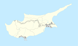
Agios Iakovos (Template:Lang-el "Saint James"; Template:Lang-tr "golden plain", previously [Aynakofo] Error: {{Lang}}: text has italic markup (help)) is a village in Cyprus, located 9 kilometres (5.6 mi) northwest of Trikomo. It is under the de facto control of Northern Cyprus. As of 2011, Agios Iakovos had a population of 229. It has always been inhabited by Turkish Cypriots.[2] Muhtar:Erbil Kara
References
- ^ "KKTC 2011 Nüfus ve Konut Sayımı" (PDF) (in Turkish). TRNC State Planning Organization. 6 August 2013. Archived from the original (PDF) on 6 November 2013.
{{cite web}}: Unknown parameter|deadurl=ignored (|url-status=suggested) (help); Unknown parameter|trans_title=ignored (|trans-title=suggested) (help) - ^ "AGIO IAKOVOS". Internal Displacement in Cyprus. PRIO Cyprus Centre. Retrieved 17 January 2015.


