
Alston, Oregon
Alston, Oregon | |
|---|---|
 Alston Location within the state of Oregon  Alston Alston (the United States) | |
| Coordinates: 46°05′57″N 123°02′49″W / 46.09917°N 123.04694°W | |
| Country | United States |
| State | Oregon |
| County | Columbia |
| Elevation | 499 ft (152 m) |
| Time zone | UTC-8 (Pacific (PST)) |
| • Summer (DST) | UTC-7 (PDT) |
| Area code(s) | 458 and 541 |
| GNIS feature ID | 1135999[1] |
| Coordinates and elevation from Geographic Names Information System[1] | |
Alston is an unincorporated community in Columbia County in the U.S. state of Oregon.[1] It lies along U.S. Route 30 (Lower Columbia River Highway) between Rainier and Clatskanie.[2] Old Rainier Road and Alston–Mayger Road intersect Route 30 at Alston.[2]
References
- ^ a b c "Alston". Geographic Names Information System. United States Geological Survey. November 28, 1980. Retrieved April 12, 2017.
- ^ a b Oregon Atlas & Gazetteer (7th ed.). Yarmouth, Maine: DeLorme. 2008. p. 19. ISBN 0-89933-347-8.
Municipalities and communities of Columbia County, Oregon, United States | ||
|---|---|---|
| Cities | 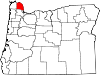 | |
| CDPs | ||
| Other unincorporated communities | ||
This Columbia County, Oregon state location article is a stub. You can help Wikipedia by expanding it. |