
Azna, Lorestan
Azna
ازنا | |
|---|---|
City | |
 | |
 Azna | |
| Coordinates: 33°27′21″N 49°27′20″E / 33.45583°N 49.45556°E | |
| Country | |
| Province | Lorestan |
| County | Azna |
| Bakhsh | Central |
| Population (2016 Census) | |
| • Total | 47,489 [1] |
| Time zone | UTC+3:30 (IRST) |
| • Summer (DST) | UTC+4:30 (IRDT) |
Azna (Persian: ازنا, also Romanized as Aznā and Eznā)[2] is a city in and capital of Azna County, Lorestan Province, Iran. At the 2011 census, its population was 41,706, in 11,594 families.[3]
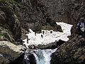
Azna is located in the Zagros Mountains.
It currently serves as a refuge camp for the Faili Kurds.[4]
This city is located 133 km. east of Khoramabad and 75 km. south of Arak. It experiences cold winters and moderate summers. The city is en route Esfahan - Khuzestan and is connected to the railway network of the country.


-
 Azna, train station
 -
 Azna, train station
 -
 Azna, train station
 -

-


References
- ^ https://www.amar.org.ir/english
- ^ Azna, Lorestan can be found at GEOnet Names Server, at this link, by opening the Advanced Search box, entering "-3054203" in the "Unique Feature Id" form, and clicking on "Search Database".
- ^ "Census of the Islamic Republic of Iran, 1390 (2011)". Islamic Republic of Iran. Archived from the original (Excel) on 2016-10-06.
- ^ "The Road Home: The Faili Kurds". Archived from the original on 2006-11-21. Retrieved 2006-12-25.
{{cite web}}: Unknown parameter|deadurl=ignored (|url-status=suggested) (help)
External links
Lorestan Province, Iran | |||||||||||||||||||||||
|---|---|---|---|---|---|---|---|---|---|---|---|---|---|---|---|---|---|---|---|---|---|---|---|
| Capital |  | ||||||||||||||||||||||
| Counties and cities |
| ||||||||||||||||||||||
| Sights |
| ||||||||||||||||||||||
| populated places | |||||||||||||||||||||||
| Capital | |||||||||||||||||||||
|---|---|---|---|---|---|---|---|---|---|---|---|---|---|---|---|---|---|---|---|---|---|
| Districts |
| ||||||||||||||||||||
This Azna County location article is a stub. You can help Wikipedia by expanding it. |