Bienfait
Appearance
Bienfait, Saskatchewan | |
|---|---|
Town | |
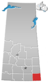
Location of Bienfait in Saskatchewan | |
| Coordinates: 49°08′47″N 102°47′44″W / 49.1465°N 102.7956°W | |
| Country | Canada |
| Province | Saskatchewan |
| Region | South East, Saskatchewan |
| Census division | 1 |
| Post office established | 1893 |
| Village | Apr 16, 1912 |
| Town | March 1, 1957 |
| Government | |
| • Mayor | Paul Carroll |
| Area | |
| • Total | 3.09 km2 (1.19 sq mi) |
| Population (2011) | |
| • Total | 780 |
| • Density | 252.4/km2 (654/sq mi) |
| Postal code | S0C 0M0 |
| Area code | 306 |
| [1][2] | |
Bienfait /ˈbiːnfeɪt/ is a town in Saskatchewan on Highway 18 located 14 km (9 miles) east of Estevan. It is located 30 km northwest of the town of North Portal, which is next to the Canada/US border. Also 10 km south of Estevan, a small city. It only has 1 school, restaurant and gas station
History
The town of Bienfait was incorporated as the Village of Bienfait on April 16, 1912 becoming a town on March 1, 1957. The town was named by the Canadian Pacific Railway after Antoine Charles Bienfait, a banker with Adolphe Boissevain & Company of Amsterdam, due to the firm's involvement in the sale of CP shares in Europe.[3]
In 1931 striking coal miners marched from Bienfait to nearby Estevan, resulting in the Estevan Riot.
Demographics
Canada census – Bienfait community profile
| 2011 | |
|---|---|
| Population | 780 (+4.3% from 2006) |
| Land area | 3.09 km2 (1.19 sq mi) |
| Population density | 252.4/km2 (654/sq mi) |
| Median age | 33.2 (M: 33.6, F: 32.6) |
| Private dwellings | 330 (total) |
| Median household income |
See also
References
- ^ National Archives, Archivia Net. "Post Offices and Postmasters". Archived from the original on 6 October 2006. Retrieved 6 September 2009.
{{cite web}}: Unknown parameter|deadurl=ignored (|url-status=suggested) (help) - ^ Government of Saskatchewan, MRD Home. "Municipal Directory System". Archived from the original on January 15, 2016. Retrieved 2014-03-11.
{{cite web}}: Unknown parameter|deadurl=ignored (|url-status=suggested) (help) - ^ Bienfait Saskatchewan, History and Genealogy Page
- ^ "2011 Community Profiles". 2011 Canadian Census. Statistics Canada. March 21, 2019. Retrieved 2012-12-24.
- ^ "2006 Community Profiles". 2006 Canadian Census. Statistics Canada. August 20, 2019.
- ^ "2001 Community Profiles". 2001 Canadian Census. Statistics Canada. July 18, 2021.
- Endicott, Stephen (2002). Bienfait: The Saskatchewan Miners' Struggle of '31. Toronto: University of Toronto Press. ISBN 0-8020-8452-4.


