
Billingsley, Alabama
Billingsley, Alabama | |
|---|---|
 Location in Autauga County and the state of Alabama | |
| Country | United States |
| State | Alabama |
| County | Autauga |
| Area | |
• Total | 1.2 sq mi (3 km2) |
| • Land | 1.2 sq mi (3 km2) |
| • Water | 0 sq mi (0 km2) |
| Elevation | 371 ft (113 m) |
| Population (2007)[1] | |
• Total | 122 |
| • Density | 96.7/sq mi (38.7/km2) |
| Time zone | UTC-6 (Central (CST)) |
| • Summer (DST) | UTC-5 (CDT) |
| ZIP code | 36006 |
| Area code | 205 |
| FIPS code | 01-06460 |
| GNIS feature ID | 0151686 |
Billingsley is a town in Autauga County, Alabama, United States. At the 2000 census the population was 116. According to the 2005 U.S. Census estimates, the town had a population of 121. [1] It is part of the Montgomery Metropolitan Statistical Area.
Geography
Billingsley is located at 32°39'37.498" North, 86°42'40.489" West (32.660416, -86.711247)Template:GR.
According to the U.S. Census Bureau, the town has a total area of 1.2 square miles (3.1 km²), all of it land.
Demographics
As of the censusTemplate:GR of 2000, there were 116 people, 46 households, and 33 families residing in the town. The population density was 98.6 people per square mile (38.0/km²). There were 58 housing units at an average density of 49.3/sq mi (19.0/km²). The racial makeup of the town was 90.52% White, 6.03% Black or African American, 1.72% Native American and 1.72% Pacific Islander.
There were 46 households out of which 21.7% had children under the age of 18 living with them, 54.3% were married couples living together, 15.2% had a female householder with no husband present, and 26.1% were non-families. 19.6% of all households were made up of individuals and 13.0% had someone living alone who was 65 years of age or older. The average household size was 2.52 and the average family size was 2.94.
In the town the population was spread out with 20.7% under the age of 18, 5.2% from 18 to 24, 29.3% from 25 to 44, 20.7% from 45 to 64, and 24.1% who were 65 years of age or older. The median age was 40 years. For every 100 females there were 73.1 males. For every 100 females age 18 and over, there were 84.0 males.
The median income for a household in the town was $44,688, and the median income for a family was $46,000. Males had a median income of $30,625 versus $15,750 for females. The per capita income for the town was $14,713. There were 10.0% of families and 11.7% of the population living below the poverty line, including 14.8% of under eighteens and 4.8% of those over 64.
References
- ^ "Annual Estimates of the Population for Incorporated Places in Alabama". United States Census Bureau. 2008-07-10. Retrieved 2008-07-14.
32°39′37″N 86°42′40″W / 32.660416°N 86.711247°W
Municipalities and communities of Autauga County, Alabama, United States | ||
|---|---|---|
| Cities | 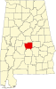 | |
| Towns | ||
| CDPs | ||
| Unincorporated communities | ||
| Ghost town | ||
| Footnotes | ‡This populated place also has portions in an adjacent county or counties | |