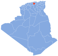
Bouïra
36°22′48″N 3°54′5″E / 36.38000°N 3.90139°E

Bouïra (Berber: Tubirett, ⵜⵓⴱⵉⵔⴻⵜⵜ) is the capital of Bouïra Province, Algeria.
Demographics
It has 75,086 inhabitants as of the 1998 census,[1] which gives it 15 seats in the PMA.
| Year | Population[2] |
|---|---|
| 1954 | 18,200 |
| 1966 | 16,600 |
| 1987 | 35,600 36,500 (municipality) |
| 1998 | 52,500 |
Geography
It is located in the geographical heart of the province. It borders the municipality of Ait Laziz in the north, Aïn Turk in the north-east (home to the largest aqueduct in Africa), Aïn El Hadjar in the east, El Hachimia in the south-east, Oued El Berdi in the south, El Asnam in the south-west, Haizer in the west, and Taghzourt in the north-west.
Twin towns
Bouïra is twinned with:
References


