Boundji Airport
Appearance
Boundji Airport | |||||||||||
|---|---|---|---|---|---|---|---|---|---|---|---|
| Summary | |||||||||||
| Airport type | Public | ||||||||||
| Serves | Boundji, Republic of the Congo | ||||||||||
| Elevation AMSL | 380 m / 1,247 ft | ||||||||||
| Coordinates | 1°01′52″S 15°20′05″E / 1.03111°S 15.33472°E | ||||||||||
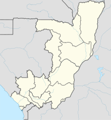
| Map | |||||||||||
 | |||||||||||
| Runways | |||||||||||
| |||||||||||
Boundji Airport (IATA: BOE, ICAO: FCOB) is an airport serving the city of Boundji in Cuvette Department, Republic of the Congo. The runway is on the western edge of the city, and has an additional 700 metres (2,300 ft) of cleared, unpaved overrun on its western end.
See also
[edit] Republic of the Congo portal
 Aviation portal
- List of airports in the Republic of the Congo
- Transport in the Republic of the Congo
References
[edit]- ^ Airport information for Boundji Airport at Great Circle Mapper.
- ^ Google Maps - Boundji
External links
[edit]

