
Burleigh, New Jersey
Burleigh, New Jersey | |
|---|---|
 House in Burleigh | |
 Map of the former Whitesboro-Burleigh CDP in Cape May County. Inset: Location of Cape May County in New Jersey. | |
| Coordinates: 39°02′51″N 74°50′48″W / 39.047486°N 74.846665°W | |
| Country | |
| State | |
| County | Cape May |
| Township | Middle |
| Area | |
| • Total | 1.550 sq mi (4.015 km2) |
| • Land | 1.518 sq mi (3.932 km2) |
| • Water | 0.032 sq mi (0.083 km2) 2.07% |
| Elevation | 10 ft (3 m) |
| Population | |
| • Total | 725 |
| • Density | 477.5/sq mi (184.4/km2) |
| Time zone | UTC-5 (Eastern (EST)) |
| • Summer (DST) | UTC-4 (Eastern (EDT)) |
| ZIP code | |
| Area code | 609 |
| FIPS code | 3408890[1][5] |
| GNIS feature ID | 02583977[1][6] |
Burleigh is an unincorporated community and census-designated place (CDP) located within Middle Township in Cape May County, New Jersey, United States; Until the 2000 Census the area had been part of the Whitesboro-Burleigh CDP, which was split in 2010 into separate CDPs for Burleigh and Whitesboro.[7] As of the 2010 United States Census, the CDP's population was 725.[3]
Geography
According to the United States Census Bureau, the CDP had a total area of 1.550 square miles (4.015 km2), including 1.518 square miles (3.932 km2) of land and 0.032 square miles (0.083 km2) of water (2.07%).[1][8]
Demographics
| Census | Pop. | Note | %± |
|---|---|---|---|
| 2010 | 725 | — | |
| Population sources: 2010[3] | |||
Census 2010
References
- ^ a b c d Gazetteer of New Jersey Places, United States Census Bureau. Accessed July 21, 2016.
- ^ U.S. Geological Survey Geographic Names Information System: Burleigh Census Designated Place, Geographic Names Information System. Accessed October 18, 2012.
- ^ a b c DP-1 - Profile of General Population and Housing Characteristics: 2010 Demographic Profile Data for Burleigh CDP, New Jersey, United States Census Bureau. Accessed October 18, 2012.
- ^ Look Up a ZIP Code for Burleigh, NJ, United States Postal Service. Accessed October 18, 2012.
- ^ American FactFinder, United States Census Bureau. Accessed September 4, 2014.
- ^ US Board on Geographic Names, United States Geological Survey. Accessed September 4, 2014.
- ^ New Jersey: 2010 - Population and Housing Unit Counts - 2010 Census of Population and Housing (CPH-2-32), United States Census Bureau, August 2012, pg. III-3. Accessed October 18, 2012. "Cape May County—New CDPs: Belleplain, Burleigh (formed from part of deleted Whitesboro-Burleigh CDP and additional area), and Whitesboro (formed from part of deleted Whitesboro-Burleigh CDP); Deleted CDPs: Whitesboro-Burleigh (split to form all of Whitesboro and part of Burleigh CDPs)."
- ^ US Gazetteer files: 2010, 2000, and 1990, United States Census Bureau. Accessed September 4, 2014.
External links
- The Cape May County Gazette, community newspaper
- The Beachcomber
Municipalities and communities of Cape May County, New Jersey, United States | ||
|---|---|---|
| Cities | 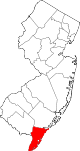 | |
| Boroughs | ||
| Townships | ||
| CDPs | ||
| Other communities | ||