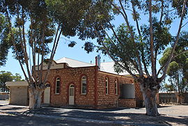
Cambrai, South Australia
Appearance
| Cambrai South Australia | |
|---|---|
 Institute | |
| Coordinates | 34°39′S 139°17′E / 34.650°S 139.283°E |
| Population | 5012006 Census [1] |
| Postcode(s) | 5353 [2] |
| LGA(s) | Mid Murray Council |
| State electorate(s) | Schubert |
| Federal division(s) | Barker |
Cambrai is a small town located on the eastern side of the Mount Lofty Ranges, along the River Marne and at the northern end of the former Apamurra to Sedan railway line. Originally named Rhine Villa, it was one of many Australian towns renamed during World War I to remove any connection with German place names and named after the Battle of Cambrai.
References
Wikimedia Commons has media related to Cambrai, South Australia.
- ^ Australian Bureau of Statistics (25 October 2007). "Cambrai (State Suburb)". 2006 Census QuickStats. Retrieved 23 October 2008.
- ^ Cambrai Postcode Australia Post

