Chã de Igreja
Appearance
Chã de Igreja | |
|---|---|
Settlement | |
 Chã de Igreja | |
| Coordinates: 17°09′26″N 25°09′49″W / 17.157084°N 25.163512°W | |
| Country | Cape Verde |
| Island | Santo Antão |
| Municipality | Ribeira Grande |
| Civil parish | São Pedro Apóstolo |
| Population (2010)[1] | |
| • Total | 672 |
| ID | 11401 |

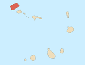
Chã de Igreja is a town[2] in the northern part of the island of Santo Antão, Cape Verde. It is situated near the north coast of the island, in the valley of the river Ribeira da Garça, 19 km northwest of the island capital Porto Novo. In 2010 its population was 672. The nature reserve Cruzinha, which includes the small seaside village Cruzinha da Garça (part of Chã de Igreja), stretches northeast of Chã de Igreja along the coast.
See also
[edit]References
[edit]- ^ "2010 Census results". Instituto Nacional de Estatística Cabo Verde (in Portuguese). 24 November 2016.
- ^ Cabo Verde, Statistical Yearbook 2015, Instituto Nacional de Estatística, p. 32-33


