Cheltenham, Auckland
Cheltenham | |
|---|---|
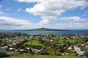
 Cheltenham seen from Mount Victoria. | |
| Country | New Zealand |
| City | Auckland Council |
| Electoral ward | North Shore |
| Vauxhall | Vauxhall | (Hauraki Gulf) |
| Devonport |
|
(Hauraki Gulf) |
| (Waitemata Harbour) | (Waitemata Harbour) | (North Head) |
Cheltenham is a North-Eastern suburb of Auckland, New Zealand. It gets its name from the English town of Cheltenham, and provides a view of Rangitoto Island from its beachfront areas. The suburb is in the North Shore ward, one of the thirteen administrative divisions of Auckland Council. The area includes North Head, Cheltenham Beach, McHughs of Cheltenham(buffet restaurant), and Balmain Reserve.
Other Cheltenhams

There are at least seven other places in the World named "Cheltenham."
- Cheltenham, England, United Kingdom (namesake)
- Cheltenham Township, Pennsylvania, United States
- Cheltenham, St. Louis, Missouri, United States
- Cheltenham, Ontario, Canada
- Cheltenham, New South Wales, Australia
- Cheltenham, Victoria, Australia
- Cheltenham, Manawatu-Wanganui, New Zealand
References
External links
- Photographs of Cheltenham held in Auckland Libraries' heritage collections.
40°09′S 175°40′E / 40.150°S 175.667°E
Cheltenham is also a village NE of Feilding in the Manawatu. It has a Pub, Shop, Takeways, Fire Station and is at the intersection of the Vinegar Hill & Kimbolton Highways.
