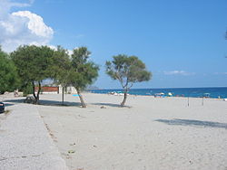
Condofuri
Appearance
Condofuri | |
|---|---|
| Comune di Condofuri | |
 | |
| Country | Italy |
| Region | Calabria |
| Province | Reggio Calabria (RC) |
| Frazioni | Amendolea, Bandiera, Barone, Carcara, Gallicianò, Grotte, Lapsè, Limmara, Lugarà, Mangani, Muccari, Palermo, Plembaci, Rodì, Rossetta, San Carlo, Santa Lucia, Schiavo, Stazione |
| Area | |
| • Total | 58.5 km2 (22.6 sq mi) |
| Elevation | 339 m (1,112 ft) |
| Population (31 December 2010)[2] | |
| • Total | 4,977 |
| • Density | 85/km2 (220/sq mi) |
| Demonym | Condofurioti |
| Time zone | UTC+1 (CET) |
| • Summer (DST) | UTC+2 (CEST) |
| Postal code | 89030 |
| Dialing code | 0965 |
| Website | Official website |
Condofuri ([Kontofyria, or Kontochòri] Error: {{Lang-xx}}: text has italic markup (help)) is a comune (municipality) in the Province of Reggio Calabria in the Italian region Calabria, located about 120 kilometres (75 mi) southwest of Catanzaro and about 38 kilometres (24 mi) southeast of Reggio Calabria.
Condofuri borders the following municipalities: Bova, Bova Marina, Roccaforte del Greco, Roghudi, San Lorenzo.
References
- ^ "Superficie di Comuni Province e Regioni italiane al 9 ottobre 2011". Italian National Institute of Statistics. Retrieved 16 March 2019.
- ^ All demographics and other statistics from the Italian statistical institute (Istat)
External links


