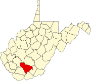
Egeria, West Virginia
Appearance
Egeria, West Virginia | |
|---|---|
| Country | United States |
| State | West Virginia |
| Counties | Mercer and Raleigh |
| Elevation | 2,972 ft (906 m) |
| Time zone | UTC-5 (Eastern (EST)) |
| • Summer (DST) | UTC-4 (EDT) |
| Area code(s) | 304 & 681 |
| GNIS feature ID | 1549668[1] |
Egeria is an unincorporated community in Mercer and Raleigh counties, West Virginia, United States. Egeria is 8.5 miles (13.7 km) north-northeast of Matoaka.
References


