Glover's Wood

Coordinates: 51°09′04″N 0°14′35″W / 51.151°N 0.243°W / 51.151; -0.243
From Wikipedia, the free encyclopedia

This is an old revision of this page, as edited by InternetArchiveBot (talk | contribs) at 02:52, 20 October 2017 (Rescuing 1 sources and tagging 0 as dead. #IABot (v1.6beta)). The present address (URL) is a permanent link to this revision, which may differ significantly from the current revision.

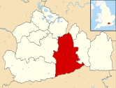
51°09′04″N 0°14′35″W / 51.151°N 0.243°W / 51.151; -0.243 Glover's Wood is a Site of Special Scientific Interest located just outside Charlwood in Surrey, England. [1] It is a broadleaved woodland with sections of ancient hornbeam coppice and oak. It is dissected by the deeply incised Welland Gill, a small tributary of the River Mole.[2]

References

External links