
Gobbler, Arkansas
Gobbler (also known as Gobbler's Point)[1] is an unincorporated community in southern Carroll County, Arkansas, United States.[2] The community is located at the intersection of U.S. Route 412 and Arkansas Highway 103, approximately ten miles south of Green Forest.[3] The location is on a ridge between the headwaters of Piney Creek to the northwest and a small tributary to Osage Creek to the southeast.at an elevation of 1,657 ft (505 m).[2]
Gobbler has been noted for its unusual place name.[4] The community was established in the 1800s by Alexander Wilson, who moved into the area from Tennessee, where he was born in 1825. Wilson provided land for the community school, church and cemetery. The village school was active until the 1940s.[1]
References
- ^ a b History of Gobbler
- ^ a b U.S. Geological Survey Geographic Names Information System: Gobbler, Arkansas
- ^ Arkansas Atlas & Gazetteer, DeLorme, 2nd ed., 2004, p. 23-4 ISBN 0-89933-345-1
- ^ Thompson, George E. (1 July 2009). You Live Where?: Interesting and Unusual Facts about where We Live. iUniverse. p. 7. ISBN 978-1-4401-3421-0.
Municipalities and communities of Carroll County, Arkansas, United States | ||
|---|---|---|
| Cities | 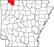 | |
| Towns | ||
| Townships | ||
| Unincorporated communities | ||
| Ghost towns | ||
| Footnotes | ‡This populated place also has portions in an adjacent county or counties | |
36°11′19″N 93°27′23″W / 36.18861°N 93.45639°W
This Arkansas state location article is a stub. You can help Wikipedia by expanding it. |