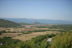
Gornja Ploča
Appearance
Gornja Ploča | |
|---|---|
Village | |
 Gornja Ploča | |
| Coordinates: 44°26′39″N 15°39′52″E / 44.44417°N 15.66444°E | |
| Country | |
| Region | Lika |
| County | Lika-Senj County |
| Municipality | Lovinac |
| Elevation | 625 m (2,051 ft) |
| Population (2011 census) | |
• Total | 45 |
| Time zone | UTC+1 (CET) |
| • Summer (DST) | UTC+2 (CEST) |
| Postal code | 53244 |
| Area code | 053 |

Gornja Ploča is a village in the Lika-Senj County, Croatia. The settlement is administered as a part of Lovinac municipality.
Location
Gornja Ploča is placed between Gospić and Gračac. It is located 27 kilometers from Gospić, 8 kilometres from Lovinac, and 3.6 kilometers from the Zagreb-Split highway. Gornja Ploča is located on state road D522, that connects the highway with Udbina and Plitvice.
Population/Demographics
According to national census of 2001, population of the settlement is 22. The majority of the population are Serbs.[1]
| Year | Population[2] |
|---|---|
| 1857 | 1,163 |
| 1869 | 1,343 |
| 1880 | 1,287 |
| 1890 | 1,435 |
| 1900 | 1,555 |
| 1910 | 1,410 |
| 1921 | 1,452 |
| 1931 | 1,502 |
| 1948 | 996 |
| 1953 | 939 |
| 1961 | 924 |
| 1971 | 675 |
| 1981 | 494 |
| 1991 | 344 |
| 2001 | 22 |
| 2011 | 45[3] |
References
- ^ "2001 census by settlement". Central Bureau of Statistics (Croatia) (in Croatian). March 31, 2001. Retrieved September 15, 2010.
- ^ "1857-2001 census by settlement". Central Bureau of Statistics (Croatia) (in Croatian). Archived from the original on 2012-05-05.
{{cite news}}: Unknown parameter|deadurl=ignored (|url-status=suggested) (help) - ^ "2011 census by settlement". Central Bureau of Statistics (Croatia) (in Croatian). 2011. Retrieved July 3, 2013.
Sources
Wikimedia Commons has media related to Gornja Ploča.

