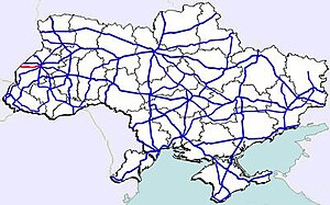
Highway M11 (Ukraine)
| Highway M11 | |
|---|---|
| Автошлях М11 | |
 | |
| Route information | |
| Length | 72.1 km (44.8 mi) |
| Major junctions | |
| East end | (Lviv) Template:European route E Template:European route E Template:European route E |
| West end | (Shehyni) (28) |
| Location | |
| Country | Ukraine |
| Regions | Lviv Oblast |
| Highway system | |
![]() M 11 is a Ukraine international highway (M-highway) connecting Lviv with Przemyśl across the Polish - Ukrainian border, where it transits to the Polish National Road 28 (dk 28).[1][2]
M 11 is a Ukraine international highway (M-highway) connecting Lviv with Przemyśl across the Polish - Ukrainian border, where it transits to the Polish National Road 28 (dk 28).[1][2]
The route serves as an alternative to ![]() M 10 that is part of Template:European route E.
M 10 that is part of Template:European route E.
Route
| Highway M11 | |||
| Marker | Main settlements | Notes | Highway Interchanges |
|---|---|---|---|
| 0 km | Lviv | Template:European route E/Template:European route E( | |
| 1.5 km | Rudne | H13 | |
| 20 km | Horodok | ||
| 40 km | Sudova Vyshnia | P40 | |
| 58.5 km | Mostyska | ||
| 72 km | Shehyni / Border (Poland) | 28 | |
See also
References
External links
- International Roads in Ukraine in Russian
- European Roads in Russian

