Hillesøy Municipality
Hillesøy Municipality
Hillesøy herred | |
|---|---|
 | |
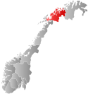
 Troms within Norway | |
 Hillesøy within Troms | |
| Coordinates: 69°35′53″N 18°1′54″E / 69.59806°N 18.03167°E | |
| Country | Norway |
| County | Troms |
| District | Hålogaland |
| Established | 1855 |
| • Preceded by | Lenvik in 1855 |
| Disestablished | 1 Jan 1964 |
| • Succeeded by | Lenvik and Tromsø in 1964 |
| Administrative centre | Brensholmen |
| Area (upon dissolution) | |
| • Total | 458 km2 (177 sq mi) |
| Population (1964) | |
| • Total | 2,475 |
| • Density | 5.4/km2 (14/sq mi) |
| Demonym | Hillesøyværing[1] |
| Time zone | UTC+01:00 (CET) |
| • Summer (DST) | UTC+02:00 (CEST) |
| ISO 3166 code | NO-1930[2] |
Hillesøy is a former municipality in Troms county in Norway. The municipality existed from 1855 until its dissolution in 1964. It was located on both sides of the Malangen fjord in what is now the present-day municipalities of Tromsø and Lenvik. The administrative centre was located at Brensholmen on the western shore of the island of Kvaløya. Brensholmen is also the location of Hillesøy Church, the main church for the municipality.[3]
Hillesøy Municipality included about 458 square kilometres (177 sq mi) of land with 164 square kilometres (63 sq mi) on the island of Senja, about 263 square kilometres (102 sq mi) on the island of Kvaløya, and about 31 square kilometres (12 sq mi) of smaller islands including Hillesøya and Sommarøya. On Senja island, Hillesøy Municipality included the larger villages of Fjordgård, Husøy, and Botnhamn. On Kvaløya island, it included Ersfjordbotn and Brensholmen. The island of Sommarøya is connected to the large island of Kvaløya by the Sommarøy Bridge. Most of the other islands are only accessible by boat.[4]
History
The municipality of Hillesøy (originally spelled Hillesø) was established in 1855 when it was separated from the large Lenvik Municipality (or it might have been in 1871–some sources do not concur).[5][6] The initial population of Hillesøy was around 800 people. During the 1960s, there were many municipal mergers across Norway due to the work of the Schei Committee. On 1 January 1964, Hillesøy Municipality was dissolved and its lands were divided as follows:
- The areas of Hillesøy on Kvaløya as well as all of the islands north of the Malangen fjord (with 1,316 inhabitants in total) were merged with the city of Tromsø (population: 12,602), the whole municipality of Tromsøysund (population: 16,727), and all of the municipality of Ullsfjord except the Svensby area (population: 2,019) to form a new, enlarged Tromsø Municipality.
- The areas of Hillesøy on the island of Senja and the little island of Hekkingen (with 1,159 inhabitants in total) merged with Lenvik Municipality (population: 8,825), the part of Tranøy Municipality along the south shore of the river Lakselva (population: 106), and the part of Sørreisa Municipality on Senja island (population: 129) to form a new, larger Lenvik Municipality.[3][5][6]
Name
The municipality is named after the old Hillesøy farm (Old Norse: Hildulfsøy) on the island of Hillesøya since that is where the Hillesøy Church was originally located. The first element of the old name comes from the old male name Hildulfr and the last part is identical with the word for "island". Another possibility for the meaning of the name is Hellisøy, where the first element comes from the work hellir which means "rock slab" and the last element again meaning "island".[3][7]
See also
References
- ^ "Navn på steder og personer: Innbyggjarnamn" (in Norwegian). Språkrådet.
- ^ Bolstad, Erik; Thorsnæs, Geir, eds. (26 January 2023). "Kommunenummer". Store norske leksikon (in Norwegian). Kunnskapsforlaget.
- ^ a b c Thorsnæs, Geir, ed. (24 June 2018). "Hillesøy". Store norske leksikon (in Norwegian). Kunnskapsforlaget. Retrieved 30 July 2018.
- ^ "Hillesøy Kommune - kommune nr. 1930" (in Norwegian). Hillesøyforeninga. 24 January 2004.
- ^ a b Jukvam, Dag (1999). "Historisk oversikt over endringer i kommune- og fylkesinndelingen" (PDF) (in Norwegian). Statistisk sentralbyrå.
{{cite journal}}: Cite journal requires|journal=(help) - ^ a b Helland, Amund (1899). "Hillesø herred". Norges land og folk: Tromsø amt (in Norwegian). Vol. XIX. Kristiania, Norway: H. Aschehoug & Company. p. 165. Retrieved 30 July 2018.
- ^ Rygh, Oluf (1911). Norske gaardnavne: Troms amt (in Norwegian) (17 ed.). Kristiania, Norge: W. C. Fabritius & sønners bogtrikkeri. p. 85.
External links
 Tromsø travel guide from Wikivoyage
- Map of Hillesøy
- Weather information for Hillesøy Template:No icon

