Holtålen
Holtålen Municipality
Holtålen kommune | |
|---|---|
|
| |
 Sør-Trøndelag within Norway | |
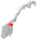
 Holtålen within Sør-Trøndelag | |
| Country | Norway |
| County | Sør-Trøndelag |
| District | Gauldal |
| Administrative centre | Ålen |
| Government | |
| • Governor (2003) | Ivar P. Volden (Ap) |
| Area | |
| • Total | 1,209 km2 (467 sq mi) |
| • Land | 1,172 km2 (453 sq mi) |
| • Rank | #83 in Norway |
| Population (2004) | |
| • Total | 2,172 |
| • Rank | #330 in Norway |
| • Density | 2/km2 (5/sq mi) |
| • Change (10 years) | |
| Demonym | Holtåling[1] |
| Official language | |
| • Norwegian form | Neutral |
| Time zone | UTC+01:00 (CET) |
| • Summer (DST) | UTC+02:00 (CEST) |
| ISO 3166 code | NO-1644[3] |
| Website | Official website |
lat_seclon_seclat_minlon_minlon_deglat_deg
Holtålen is a municipality in Sør-Trøndelag county, Norway. It is part of the Gauldal region. The administrative centre of the municipality is the village of Ålen.
Holtålen (named Haltdalen from 1938-1971) was established as a municipality on 1 January 1838 (see formannskapsdistrikt). Singsås was separated from Holtålen in 1841. Ålen was separated from Holtålen in 1860, but it was again merged with Holtålen on 1 January 1972.
General information
Name
The Old Norse forms of the name was Holtdalr and (later) Holtáll. The first element is the name of the Holta river. The last element was (first) dalr which means "valley" or "dale", but this was later (around 1400 AD) replaced by the word áll which means "ditch" or "gully". The form -ålen is the modern finite form of this word. The name of the municipality was Haltdalen from 1938 until 1972.
Coat-of-arms
The coat-of-arms is from modern times. They were granted in 1988. The arms show a grouse (Lagopus lagopus) in silver on a red background.
Geography
The Gauldal valley with the Gaula river originates from the mountainous area around the mining town of Røros 35 km south of Ålen, and is listed as a World Heritage Site. The Gaula streams to its estuary at Melhus close to Trondheim. The village of Ålen, the administrative centre of the municipality, is found where the deep valley disappears into the mountains.
Downstream is the next village Haltdalen. During the years the two villages have been separate and joined municipalities. The last fusion of the two municipalities Haltdalen (778 inhabitants) and Ålen (1944 inhabitants) in 1972 the old name Holtålen was revived.
The Kjøli and Killingdal copper mines are the northern part of the Røros area. The last mine in production was Killingdal until it closed down in 1986.
Hessdalen is a mountain valley joining the Gauldal valley close to the village of Ålen. Around 1983 Hessdalen became famous for UFO observations.
References
- ^ "Navn på steder og personer: Innbyggjarnamn" (in Norwegian). Språkrådet.
- ^ "Forskrift om målvedtak i kommunar og fylkeskommunar" (in Norwegian). Lovdata.no.
- ^ Bolstad, Erik; Thorsnæs, Geir, eds. (2023-01-26). "Kommunenummer". Store norske leksikon (in Norwegian). Kunnskapsforlaget.


