
Izvoru Crișului
Izvoru Crișului
Körösfő | |
|---|---|
Commune | |
 Location in Cluj County | |
 Location on Romania map | |
| Coordinates: 46°50′10″N 23°06′32″E / 46.83611°N 23.10889°E | |
| Country | |
| County | Cluj County |
| Status | Commune |
| Settled | 1276 |
| Commune seat | Izvoru Crişșului |
| Villages | Izvoru Crișului, Nadășu, Nearșova, Șaula |
| Government | |
| • Mayor | János Antal |
| Area | |
| • Total | 41.37 km2 (15.97 sq mi) |
| Population (2011)[1] | |
| • Total | 1,616 |
| • Density | 39/km2 (100/sq mi) |
| Time zone | UTC+2 (EET) |
| • Summer (DST) | UTC+3 (EEST) |
| Area code | +40 x64[2] |
| Website | http://www.cjcluj.ro/izvoru-crisului/ |
Izvoru Crișului (Romanian: Izvoru Crișului; Hungarian: Körösfő, German: Krieschwej); is a commune in Cluj County, Romania. It is composed of four villages: Izvoru Crișului, Nadășu (Kalotanádas), Nearșova (Nyárszó) and Șaula (Sárvásár).
Demographics
At the 2011 census, 79.95% of inhabitants were Hungarians and 19.9% Romanians.[1]
Notes
- ^ a b "Comunicat de presă privind rezultatele provizorii ale Recensământului Populaţiei şi Locuinţelor – 2011" (PDF) (in Romanian). INSSE. February 2, 2012. Retrieved 2012-03-26.
- ^ x is a digit indicating the operator: 2 for the former national operator, Romtelecom, and 3 for the other ground telephone networks
References
- Atlasul localităților județului Cluj (Cluj County Localities Atlas), Suncart Publishing House, Cluj-Napoca, ISBN 973-86430-0-7
Images
Wikimedia Commons has media related to Izvoru Crişului.
-
 The Reformed church
 -
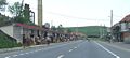
 Trade in Izvoru Crişului
 -
 Trade in Izvoru Crişului
 -
 Trade in Izvoru Crişului


This Cluj County location article is a stub. You can help Wikipedia by expanding it. |