
Kings Park, New South Wales
| Kings Park Sydney, New South Wales | |||||||||||||||
|---|---|---|---|---|---|---|---|---|---|---|---|---|---|---|---|
 Blacktown Indoor Sports Centre, Kings Park | |||||||||||||||
 | |||||||||||||||
| Population | 3,453 (2016 census)[1] | ||||||||||||||
| Established | 1987 | ||||||||||||||
| Postcode(s) | 2148 | ||||||||||||||
| Elevation | 63 m (207 ft) | ||||||||||||||
| Location | 40 km (25 mi) west of Sydney CBD | ||||||||||||||
| LGA(s) | City of Blacktown | ||||||||||||||
| State electorate(s) | Blacktown | ||||||||||||||
| Federal division(s) | Greenway | ||||||||||||||
| |||||||||||||||
Kings Park is a suburb of Sydney, in the state of New South Wales, Australia. Kings Park is located 40 km west of the Sydney central business district, in the local government area of the City of Blacktown and part of the Greater Western Sydney region.
Description[edit]
Kings Park is bounded by the Richmond railway line to the west, the Westlink M7 to the north, Sunnyholt Road to the east and Breakfast Creek to the south. The southern half of the suburb is industrial while the northern half is newer residential homes. There are no schools or shopping centres within Kings Park with these facilities found in the neighbouring suburbs of Marayong, Blacktown and Kings Langley. The major landmarks are St Andrews church, and Blacktown Indoor Sports centre near Marayong railway station and Faulkland Crescent Reserve in the northern part of the suburb.
The suburb has three Christian church denominations represented, Catholic, Brethren and Pentecostal. A Hindu Temple is also in the suburb, while a Sikh temple is located nearby.
History[edit]
Kings Park was originally part of Marayong, but with increased residential development, residents wanted a separate identity, and the developer's estate name was adopted in 1987.[2]
-
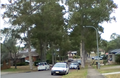 Street scene in Kings Park, New South Wales
 -
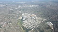 Kings Park area
 -
 Kings Park looking west with Westlink M7 reserve to the right behind trees


3.png)
Population[edit]
In the 2016 Census, there were 3,453 people in Kings Park. 69.9% of people were born in Australia. The next most common countries of birth were Philippines 3.0%, India 3.0% and England 2.9%. 75.3% of people spoke only English at home. The most common responses for religion were Catholic 32.4%, No Religion 21.3% and Anglican 15.2%.[1]
Economy[edit]
Kings Park is the current headquarters of Ichijo Homes, a company that builds energy-efficient houses.[3]
Transport[edit]
The suburb is served by Marayong railway station on the Richmond railway line and the Blacktown-Parklea branch of the North-West T-way.
References[edit]
- ^ a b Australian Bureau of Statistics (27 June 2017). "Kings Park (State Suburb)". 2016 Census QuickStats. Retrieved 15 March 2018.
- ^ "Kings Park". Geographical Names Register (GNR) of NSW. Geographical Names Board of New South Wales. Retrieved 4 August 2013.
- ^ Wellings, Susan (6 October 2012). "Power to the people". Domain. Retrieved 1 October 2023.
33°44′13″S 150°54′04″E / 33.737°S 150.901°E
This article related to the geography of Sydney is a stub. You can help Wikipedia by expanding it. |