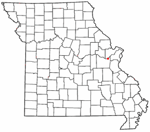
Labadie, Missouri

Labadie is an unincorporated community in Franklin County, Missouri, United States. It is located about three miles north of Gray Summit. The community is named after Sylvester L'Abaddie,[1] a hunter who (by some accounts) was killed by a bear in nearby Labaddie's Cave. A county history published in 1968, however, records that he "died peacefully in his bed in his 70th year, on July 25, 1849, at his home on Olive Street in St. Louis." [2] Labadie post office was established June 7, 1855. Labaddie Creek enters the Missouri River here, and this was the location of Labaddie Station of the Missouri Pacific Railroad.
References
- ^ Eaton, David Wolfe (1916). How Missouri Counties, Towns and Streams Were Named. The State Historical Society of Missouri. p. 167.
- ^ Historical Review of Franklin County, Missouri, 1818-1968, p. 27. (Melvin B. Roblee & Vera L. Osiek, editors) (1968). Union, Missouri: Franklin County Sesqui-centennial Corporation.
38°31′44″N 90°51′00″W / 38.52889°N 90.85000°W
The l'abaddies were the Counts of St. Castin. Came into Canada as ambassadors of the French King.

