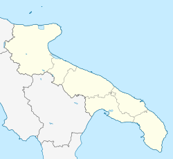
Lizzano, Apulia
Lizzano | |
|---|---|
| Comune di Lizzano | |
 | |
| Coordinates: 40°23′31″N 17°26′54″E / 40.39194°N 17.44833°E | |
| Country | Italy |
| Region | Apulia |
| Province | Taranto (TA) |
| Frazioni | Marina di Lizzano |
| Government | |
| • Mayor | Antonietta D'Oria |
| Area | |
| • Total | 46 km2 (18 sq mi) |
| Elevation | 42 m (138 ft) |
| Population (30 September 2017)[2] | |
| • Total | 10,005 |
| • Density | 220/km2 (560/sq mi) |
| Demonym | Lizzanesi |
| Time zone | UTC+1 (CET) |
| • Summer (DST) | UTC+2 (CEST) |
| Postal code | 74020 |
| Dialing code | 099 |
| Patron saint | St. Cajetan of Thiene, St. Paschal Baylon |
| Saint day | 7 August, 17 May |
| Website | Official website |
Lizzano (Salentino: Lizzanu; Latin: Licyanum) is a comune of 10,175 inhabitants (2013) in the province of Taranto in the Apulia region of southeast Italy.
Lizzano DOC[edit]
The area around Lizzano produces red, white, rose and sparkling Italian DOC wines. Grapes destined for reds and roses are limited to a harvest yield of 14 tonnes/ha with the finished wine needing to have a minimum alcohol level of 11.5%. White wine grapes are limited to a harvest yield of 12 tonnes/ha with minimum alcohol level of 10.5% The reds, roses and frizzante roses are blends composed primarily of Negroamaro (60-80%) with Montepulciano, Sangiovese, Bombino nero and Pinot noir making up the remaining. Malvasia nera can also be used but is limited to 10% of the blend. The whites, frizzantes and spumantes are a blend of 40-60% Trebbiano, at least 30% Chardonnay and/or Pinot blanc, up to 25% Sauvignon blanc and/or Bianco di Alessano and up to 10% Malvasia bianca.[3]
Climate[edit]
Lizzano has a Hot Summer Mediterranean Climate with an annual average temperature of 17.45 C.
| Climate data for Lizzano (1972-2001) | |||||||||||||
|---|---|---|---|---|---|---|---|---|---|---|---|---|---|
| Month | Jan | Feb | Mar | Apr | May | Jun | Jul | Aug | Sep | Oct | Nov | Dec | Year |
| Mean daily maximum °C (°F) | 13.5 (56.3) |
14.0 (57.2) |
16.2 (61.2) |
19.0 (66.2) |
24.4 (75.9) |
28.7 (83.7) |
32.1 (89.8) |
32.0 (89.6) |
27.9 (82.2) |
22.9 (73.2) |
17.8 (64.0) |
14.5 (58.1) |
21.9 (71.5) |
| Mean daily minimum °C (°F) | 6.0 (42.8) |
6.1 (43.0) |
7.7 (45.9) |
10.2 (50.4) |
14.7 (58.5) |
18.2 (64.8) |
20.9 (69.6) |
21.1 (70.0) |
18.1 (64.6) |
14.2 (57.6) |
9.9 (49.8) |
7.1 (44.8) |
12.9 (55.2) |
| Source: Super Meteo [1] | |||||||||||||
See also[edit]
References[edit]
- ^ "Superficie di Comuni Province e Regioni italiane al 9 ottobre 2011". Italian National Institute of Statistics. Retrieved 16 March 2019.
- ^ Population from ISTAT
- ^ P. Saunders Wine Label Language pg 174 Firefly Books 2004 ISBN 1-55297-720-X
External links[edit]
- Italian Made "Lizzano DOC"


