
Mampad
This article needs additional citations for verification. (August 2016) |
.jpg)
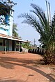
Mampad
മമ്പാട് | |
|---|---|
town | |
.jpg) Mampad Hanging Bridge | |
| Coordinates: 11°08′37″N 76°06′43″E / 11.1437°N 76.1119°E | |
| Country | |
| State | Kerala |
| District | Malappuram |
| Languages | |
| • Official | Malayalam, English |
| Time zone | UTC+5:30 (IST) |
| Telephone code | 04931 |
| Vehicle registration | KL-71 |
| Climate | Am (Köppen) |

.jpg)
Mampad is a growing town in Malappuram district, Kerala, India. located about 08 km east of Nilambur city. Nearby places include Edavanna, Areacode, Manjeri, Wandoor and Pandikkad. It is under the Wandoor Assembly Constituency. Kozhikode-Nilambur-Gudalur (CNG Road) SH pass through here. The Mampad town is now developing day to day. Most people are engaged in agriculture and business activities. Hindus, Christians and Muslims co-exist in harmony adding to the diversity in faith and religion.
Schools
- Mampad High School
- *Pullipadam LP School
- m e s higher secondary school mampad
- g v h s s mampad
- a m a u p s mampad
- g l p s mampad
- The Springs International Schools
- Rahmanyia higher secondary school meppadam
Colleges
- NET Distance Education, (Under the Nest Educational Trust)
- MES Mampad College
Hospitals
- Life Hospital
mampad govt hospital, maternity care hospital
River
Banks
- Kerala Gramin Bank
- south indian bank
- vanitha cooperative bank
ATM
- HDFC Bank ATM
- Kerala Gramin Bank ATM
- south indian Bank ATM
- State Bank of India, SBI ATM
Places of interest
This section is empty. You can help by adding to it. (January 2015) |
Nearby Places
Edavanna Nilambur Chaliyar Vadapuram Wandoor Areacode Manjeri
Culture
This village is a predominantly Muslim populated area. Hindus exist in comparatively smaller numbers. So the culture of the locality is based upon Muslim traditions. Duff Muttu, Kolkali and Aravanamuttu are common folk arts of this locality. There are many libraries attached to mosques giving a rich source of Islamic studies. Most of the books are written in Arabi-Malayalam which is a version of the Malayalam language written in Arabic script. People gather in mosques for the evening prayer and continue to sit there after the prayers discussing social and cultural issues. Business and family issues are also sorted out during these evening meetings. The Hindu minority of this area keeps their rich traditions by celebrating various festivals in their temples. Hindu rituals are done here with a regular devotion like other parts of Kerala.[1]
Transportation
Mampad village connects to other parts of India through Nilambur town. State Highway No.28 starts from Nilambur and connects to Ooty, Mysore and Bangalore through Highways.12,29 and 181. National highway No.66 passes through Ramanattukara and the northern stretch connects to Goa and Mumbai. The southern stretch connects to Cochin and Trivandrum. State. The nearest airport is at Kozhikode. The nearest railway station is at Nilambur
Image gallery
-
 Pullippadam Mosque
 -
 Hanging Bridge to Pullippadam
 -
 River Chaliyar at Mampad
.jpg)

.jpg)
References
- ^ "Archived copy". Archived from the original on 1 April 2016. Retrieved 14 July 2016.
{{cite web}}: Unknown parameter|deadurl=ignored (|url-status=suggested) (help)CS1 maint: archived copy as title (link)