Mapaville, Missouri
Appearance

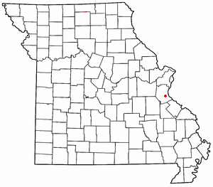
Mapaville is an unincorporated community in Jefferson County, Missouri. It is located about halfway between Festus and Hillsboro on Missouri Supplemental Route A.
38°14′56″N 90°29′00″W / 38.24889°N 90.48333°W
This is an old revision of this page, as edited by 58.60.70.198 (talk) at 08:26, 19 December 2014 (Citations needed + textbook example of original research?). The present address (URL) is a permanent link to this revision, which may differ significantly from the current revision.
This article does not cite any sources. Please help improve this article by adding citations to reliable sources. Unsourced material may be challenged and removed. Find sources: "Mapaville, Missouri" – news · newspapers · books · scholar · JSTOR (December 2009) (Learn how and when to remove this message) |

Mapaville is an unincorporated community in Jefferson County, Missouri. It is located about halfway between Festus and Hillsboro on Missouri Supplemental Route A.
Municipalities and communities of Jefferson County, Missouri, United States | ||
|---|---|---|
| Cities |  | |
| Villages | ||
| Townships | ||
| CDPs | ||
| Other communities |
| |
38°14′56″N 90°29′00″W / 38.24889°N 90.48333°W / 38.24889; -90.48333
This Jefferson County, Missouri state location article is a stub. You can help Wikipedia by expanding it. |