Masutani Dam
Appearance
You can help expand this article with text translated from the corresponding article in Japanese. (December 2008) Click [show] for important translation instructions.
|
| Masutani Dam | |
|---|---|
 | |
| Location | Minamiechizen, Fukui Prefecture, Japan |
| Coordinates | 35°44′27″N 136°14′54″E / 35.74083°N 136.24833°E |
| Construction began | 1981 |
| Opening date | 2005 |
| Dam and spillways | |
| Impounds | Masutanigawa River |
| Height | 100.4 m |
| Length | 344.8 m |
| Reservoir | |
| Total capacity | 24,200,000 m³ |
| Catchment area | 10.2 km² |
| Surface area | 89 hectares |
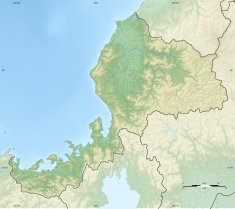
Masutani Dam (桝谷ダム, Masutani-damu) is a dam in the town of Minamiechizen, Fukui Prefecture, Japan.[1]
Masutami Dam is a multipurpose dam aimed at irrigation, flood control on the Hino River, and to provide drinking and industrial water to the cities of Fukui and Sabae. The dam is a rockfill dam with a height 100.4 meters and was built by the Ministry of Agriculture, Forestry and Fisheries. The dam is currently managed by the Fukui prefectural government.
Construction work began in 1981 and was completed in 2005.
References
- ^ "Hydropower & Dams in South and East Asia" (PDF). Hydropower and Dams. p. 9. Retrieved 3 October 2010.
Wikimedia Commons has media related to Masutani Dam.


