
Merrellton, Alabama
Merrellton, Alabama | |
|---|---|
 Merrellton, Alabama  Merrellton, Alabama | |
| Coordinates: 33°51′48″N 85°44′31″W / 33.86333°N 85.74194°W | |
| Country | United States |
| State | Alabama |
| County | Calhoun |
| Elevation | 673 ft (205 m) |
| Time zone | UTC-6 (Central (CST)) |
| • Summer (DST) | UTC-5 (CDT) |
| GNIS feature ID | 160086[1] |
Merrellton, also known as East and West Junction, Junction, and Merrelton, is an unincorporated community in Calhoun County, Alabama, United States.[1]
Merrellton is located on Alabama State Route 21, 16.6 mi (26.7 km) north of Anniston.
History
A post office was established in 1884 and was named Merrill, after the daughter of the postmistress, Adelia E. Frank. A school was established in the early 1900s.[2] The post office closed in 1923, and the school closed in 1927.[1][3]
In 1929, a tornado struck an African-American church which was used as a school, demolishing the building and killing five pupils.[4]
Merrellton was a historic junction for two now-abandoned railway lines, the East & West Railroad and the Southern Railway.[5] In 1996, the city of Jacksonville acquired from the Norfolk Southern Railway the track bed of the former Southern Railway which passed through Merrellton. The track bed was used to complete a portion of the Chief Ladiga Trail, Alabama's first rail trail.[6]
Notable people
- Herman Clarence Nixon, political scientist and member of the Southern Agrarians.[7]
References
- ^ a b c "Merrellton". Geographic Names Information System. United States Geological Survey, United States Department of the Interior.
- ^ O'Dell, Kimberly (1998). Calhoun County. Arcadia. p. 66.
- ^ "Merrellton School (historical)". Geographic Names Information System. United States Geological Survey, United States Department of the Interior.
- ^ "Freakish Storms Leave Six Dead" (PDF). The Daily Iowan. March 23, 1929.
- ^ "Calhoun County" (PDF). University of Alabama. Retrieved August 28, 2017.
- ^ "Chief Ladiga National Recreation Trail, Jacksonville and Piedmont, Alabama". National Recreation Trails. Retrieved August 28, 2017.
- ^ I'll Take My Stand: The South and the Agrarian Tradition. LSU Press. 1977. p. 388.
Municipalities and communities of Calhoun County, Alabama, United States | ||
|---|---|---|
| Cities | 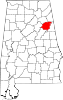 | |
| Towns | ||
| CDPs | ||
| Unincorporated communities | ||
| Ghost town | ||
| Footnotes | ‡This populated place also has portions in an adjacent county or counties | |