Mono Mills, California
Appearance
(Redirected from Mono, California)
Mono Mills | |
|---|---|
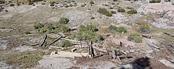
 Mono Mills ruins | |
| Coordinates: 37°53′15″N 118°57′34″W / 37.88750°N 118.95944°W | |
| Country | United States |
| State | California |
| County | Mono County |
| Elevation | 7,356 ft (2,242 m) |
Mono Mills (also, Mono)[2] is a ghost town[3] in Mono County, California.[1] It is located 9.5 miles (15 km) east-southeast of Lee Vining,[2] at an elevation of 7356 feet (2242 m).[1] Mono Mills has nearly vanished. Its site is along California State Route 120, 9.1 miles (15 km) east from the junction with U.S. Route 395.[3]
Background
[edit]Mono Mills started as a lumber camp that supplied Bodie's mines.[2] The first sawmill was built in 1880.[2] In 1881, a narrow-gauge railroad, Bodie & Benton Railway, was built from Mono Mills to Bodie.[3] At its peak, Mono Mills shipped almost 45,000 cords of wood per year.[3]
Gallery
[edit]-
Mono Mills termination point in 1914
References
[edit]- ^ a b c U.S. Geological Survey Geographic Names Information System: Mono Mills, California
- ^ a b c d Durham, David L. (1998). California's Geographic Names: A Gazetteer of Historic and Modern Names of the State. Clovis, Calif.: Word Dancer Press. p. 1186. ISBN 1-884995-14-4.
- ^ a b c d Varney, Philip; Drew, John and Susan (2001). Ghost Towns of Northern California: Your Guide to Ghost Towns & Historic Mining Camps. Stillwater, Minnesota: Voyageur Press. p. 135. ISBN 0896584445.
External links
[edit] Media related to Mono Mills (California) at Wikimedia Commons


