
Morrilton, Arkansas
Morrilton, Arkansas | |
|---|---|
 Historic downtown Morrilton | |
| Motto: "See Further!"[1] | |
 Location in Conway County and the state of Arkansas | |
| Country | United States |
| State | Arkansas |
| County | Conway |
| Area | |
• Total | 8.5 sq mi (22.1 km2) |
| • Land | 8.2 sq mi (21.3 km2) |
| • Water | 0.3 sq mi (0.8 km2) |
| Elevation | 384 ft (117 m) |
| Population (2010) | |
• Total | 6,767 |
| • Density | 770.6/sq mi (296.4/km2) |
| Time zone | UTC-6 (Central (CST)) |
| • Summer (DST) | UTC-5 (CDT) |
| ZIP code | 72110 |
| Area code | 501 |
| FIPS code | 05-46970 |
| GNIS feature ID | 0056839 |
| Website | City of Morrilton Arkansas |
Morrilton is a city in Conway County, Arkansas, United States, 51 miles (82 km) northwest of Little Rock. The city is the county seat of Conway County.Template:GR[3] The population was 6,767 at the 2010 Census.
History
Morrilton was incorporated on November 24, 1879,[2] and is named after landowners E.J. and George H. Morrill.[4]
The city was home to Harding College, now Harding University of Searcy, Arkansas, for about a decade in the 1920s and 1930s. The original campus of Harding University is now the home of the Southern Christian Home, a church supported residential child care facilty.
Geography
Morrilton is located at 35°9′23″N 92°44′31″W / 35.15639°N 92.74194°W (35.156373, -92.741944)Template:GR.
According to the United States Census Bureau, the city has a total area of 8.5 square miles (22 km2), of which 8.2 square miles (21 km2) is land and 0.3 square miles (0.78 km2) (3.75%) is water.
Demographics
As of the 2010 Census, 6,767 people and 2,759 households resided within the city.[5]
2000 Census results showed 1,724 families residing in the city. The population density was 796.7 people per square mile (307.7/km²). There were 2,947 housing units at an average density of 358.4 per square mile (138.4/km²). The racial makeup of the city was 78.38% White, 17.47% Black or African American, 0.79% Native American, 0.34% Asian, 0.02% Pacific Islander, 1.37% from other races, and 1.63% from two or more races. 3.37% of the population were Hispanic or Latino of any race.
There were 2,645 households out of which 30.1% had children under the age of 18 living with them, 46.2% were married couples living together, 15.8% had a female householder with no husband present, and 34.8% were non-families. 32.2% of all households were made up of individuals and 16.3% had someone living alone who was 65 years of age or older. The average household size was 2.35 and the average family size was 2.94.
In the city, the population was spread out with 25.4% under the age of 18, 8.7% from 18 to 24, 26.0% from 25 to 44, 20.2% from 45 to 64, and 19.7% who were 65 years of age or older. The median age was 38 years. For every 100 females there were 84.1 males. For every 100 females age 18 and over, there were 79.5 males.
The median income for a household in the city was $28,007, and the median income for a family was $36,432. Males had a median income of $30,123 versus $19,213 for females. The per capita income for the city was $16,957. About 13.4% of families and 17.1% of the population were below the poverty line, including 21.6% of those under age 18 and 12.8% of those age 65 or over.
Arts and culture
Museums and other points of interest
Former governor Winthrop Rockefeller's Winrock Farms is located near Morrilton.
Depot Museum, in the old train Depot on Railroad Ave. Open every Friday and Saturday from 10:00am to 2:00 pm
Education
Public and private schools
The community is served by two secondary schools. Morrilton High School and the South Conway County School District serve Morrilton as its public school system, where Sacred Heart Catholic School is private.
Colleges and universities
Morrilton is home to the University of Arkansas Community College at Morrilton.
Notable people
- Carl B. Close (1907-1980), Louisiana politician who served as mayor of Alexandria from 1947 to 1953, was born at Robertsville near Morrilton, the son of the country physician, Edgar Close.[6]
- Nathan Green Gordon (1916–2008), sixth Lieutenant Governor of Arkansas and distinguished United States Navy aviator during World War II; born in Morrilton.[7]
- Winthrop Rockefeller (1912-1973), governor of Arkansas from 1967 to 1971; lived at Petit Jean Mountain near Morrilton
- Sue Scott (born 1954), member of the Arkansas House of Representatives from Rogers; attended Petit Jean Vocational Technical School in Morrilton[8]
- John R. Stallings (1935–2008), mathematician known for his seminal contributions to geometric group theory and 3-manifold topology; born in Morrilton.[9]
- C. Vann Woodward (1908-1999), American historian focused primarily on the Southern United States and its individual sociology of race and ethnic relations. He attended Morrilton High School.[citation needed]
Climate
The climate in this area is characterized by hot, humid summers and generally mild to cool winters. According to the Köppen Climate Classification system, Morrilton has a humid subtropical climate, abbreviated "Cfa" on climate maps.[10]
References
- ^ "City of Morrilton Arkansas". City of Morrilton Arkansas. Retrieved September 12, 2012.
- ^ a b "Morrilton, Arkansas". City-Data.com. Retrieved September 12, 2012.
- ^ "Profile for Morrilton, Arkansas, AR". ePodunk. Retrieved September 12, 2012.
- ^ "Profile for Morrilton, Arkansas, AR". ePodunk. Retrieved September 12, 2012.
- ^ http://2010.census.gov/2010census/popmap/ipmtext.php?fl=06:0546970
- ^ "Carl Buell Close, Sr. (1907-1980)". geni.com. Retrieved July 3, 2013.
- ^ "About The Office". Arkansas Lieutenant Governors Office. 2007. Retrieved September 12, 2012.
- ^ "Sue Scott's Biography". votesmart.org. Retrieved January 4, 2014.
- ^ "Mathematician John Stallings died last year at 73". UC Berkeley. Retrieved November 28, 2013.
- ^ Climate Summary for Morrilton, Arkansas
Home of RDB Resources / Professional Copywriter Richard D Boyd / RDB Resources.com
External links
- City of Morrilton Official City Website
- Morrilton Area Chamber of Commerce Portal style website, Government, Business, Library, Recreation and more
- Main Street Morrilton
- City-Data.com Comprehensive Statistical Data and more about Morrilton
Municipalities and communities of Conway County, Arkansas, United States | ||
|---|---|---|
| Cities | 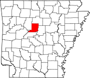 | |
| Town | ||
| CDPs | ||
| Other unincorporated communities | ||