Mount Masaraga
| Mount Masaraga | |
|---|---|
 | |
| Highest point | |
| Elevation | 1,328 m (4,357 ft) |
| Listing | List of inactive volcanoes in the Philippines |
| Geography | |
| Location | Albay, Philippines |
| Geology | |
| Mountain type | stratovolcano |
| Volcanic arc/belt | Bicol Volcanic Chain |
| Last eruption | Unknown / Holocene |
Mount Masaraga is an extinct stratovolcano, located in Ligao City in the province of Albay, in the Bicol region, on Luzon Island, in the Philippines, at latitude 13.32°N (13°20'N), longitude 123.60°E (123°35'E).
Physical features
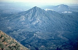
Mount Masaraga is a forested, sharp-topped, mountain with an elevation of 1,328 metres (4,357 ft) asl. It is adjacent and the closest to the perfect cone of Mayon Volcano.
Eruptions
There are no historical eruptions from the volcano with the last eruptive activity dated as Holocene as reported by the Global Volcanism Program. Thick lava flows from that period are present on the flanks of Mount Masaraga, an understudied volcano in the Philippines.
Geology
Rock type found on the mountain is andesite trending to rhyolite. Tectonically, Masaraga is part of the Bicol Volcanic Chain of volcanoes and part of the Pacific ring of fire.
Listings
The Philippine Institute of Volcanology and Seismology (PHIVOLCS) lists the mountain as one of the inactive volcanoes of the Philippines.

