
Mudbaden, Minnesota
Mudbaden, Minnesota | |
|---|---|
 Mudbaden, Minnesota Location of the community of Mudbaden within Sand Creek Township, Scott County  Mudbaden, Minnesota Mudbaden, Minnesota (the United States) | |
| Coordinates: 44°41′30″N 93°37′04″W / 44.69167°N 93.61778°W | |
| Country | United States |
| State | Minnesota |
| County | Scott |
| Township | Sand Creek Township |
| Elevation | 735 ft (224 m) |
| Time zone | UTC-6 (Central (CST)) |
| • Summer (DST) | UTC-5 (CDT) |
| ZIP code | 55352 |
| Area code | 952 |
| GNIS feature ID | 654838[1] |
Mudbaden is an unincorporated community in Sand Creek Township, Scott County, Minnesota, United States.
The community is located north-northeast of Jordan along Valley View Drive.
Nearby is the junction of U.S. Highway 169 and 173rd Street West.
Nearby places include Jordan and Shakopee. The community was noted for its sulfur springs and former spas at the Mudbaden Sulphur Springs Company from the 1890s to 1947.
References
Municipalities and communities of Scott County, Minnesota, United States | ||
|---|---|---|
| Cities | 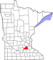 | |
| Townships | ||
| Unincorporated communities | ||
| Ghost towns/Neighborhoods | ||
| Indian reservation | ||
| Footnotes | ‡This populated place also has portions in an adjacent county or counties | |