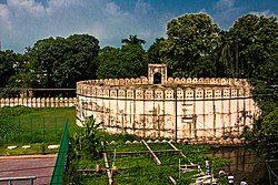
Munshiganj
Appearance
Munshiganj
মুন্সীগঞ্জ | |
|---|---|
 | |
| Coordinates: 23°33′N 90°32′E / 23.55°N 90.53°E | |
| Country | |
| Division | Dhaka |
| District | Munshiganj |
| Upazila | Munshiganj Sadar |
| Government | |
| • Type | Mayor–Council |
| • Body | Munshiganj Municipality |
| Population | |
| • Total | 70,674 |
| Time zone | UTC+6 (Bangladesh Time) |
Munshiganj is a town in Dhaka division in central Bangladesh. It is the headquarters of Munshiganj District.
Demographics
At the time of the 2011 census, Munshiganj Paurashava had 15,133 households and a population of 70,674. 14,539 (20.57%) were under 10 years of age. Munshiganj had a sex ratio of 970 females per 1000 males and a literacy rate of 65.21%.[1]
References
- ^ a b "Community Tables: Munshiganj district" (PDF). bbs.gov.bd. Bangladesh Bureau of Statistics. 2011.


