Odd Down

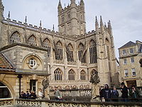
photographed in January 2006
Odd Down is an electoral ward in the City of Bath, England. A suburb of the city, Odd Down is located west and south of the city centre. The city ward population taken at the 2011 census was 5,681.[1]
History
[edit]A 1,330 yards (1,220 m) section of the Wansdyke medieval earthwork in Odd Down, which has been designated as an Ancient monument,[2] appears on the Heritage at Risk Register as being in unsatisfactory condition and vulnerable due to gardening.[3]
The Cross Keys Inn is a Grade II listed building which was built in the late 17th or early 18th century.[4] although an earlier pub on the site served as a coaching inn.[5]
Thomas Stride operated a brewery and public house in Odd Down and represented Combe Hay in the Rural District Council.
Sport
[edit]Odd Down A.F.C. is the local football club which won the 2015-16 Western Premier League.
Odd Down Playing fields has a 1.5km, purpose built, closed road cycling circuit.[6]
References
[edit]- ^ "Ward population 2011". Retrieved 7 April 2015.
- ^ Historic England. "Wansdyke: section 1230yds (1120m) eastwards from Burnt House Inn (1007003)". National Heritage List for England. Retrieved 10 October 2013.
- ^ "Wansdyke: section 1230 yards (1120 metres) eastwards from Burnt House Inn, Southstoke - Bath and North East Somerset (UA)". English Heritage. Archived from the original on 22 October 2014. Retrieved 10 October 2013.
- ^ Historic England. "Cross Keys Inn (1395715)". National Heritage List for England. Retrieved 22 June 2015.
- ^ Canvin, John. "Southstoke History" (PDF). Southstoke Parish Council. p. 14. Retrieved 22 June 2015.
- ^ "Bath cycling circuit opens at Odd Down playing fields". BBC News. 27 April 2013. Retrieved 25 April 2023.
51°21′41″N 2°22′53″W / 51.3614°N 2.3813°W

