Jump to content

Pá Mỳ

Coordinates: 22°08′N 106°34′E / 22.133°N 106.567°E / 22.133; 106.567
From Wikipedia, the free encyclopedia

This is an old revision of this page, as edited by Colonies Chris (talk | contribs) at 15:25, 7 November 2013 (sp, date & link fixes; unlinking common words, replaced: Dien Bien Province → Điện Biên Province (5), Communes of Vietnam|Commune → Commune-level subdivisions (Vietnam)|Commune (2), subdivision_name1 = [[Điệ using AWB). The present address (URL) is a permanent link to this revision, which may differ significantly from the current revision.

Pá Mỳ
Commune and village
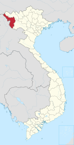
Map
Country Vietnam
ProvinceĐiện Biên
DistrictMường Nhé
Time zoneUTC+07:00 (Indochina Time)

Pá Mỳ is a commune () and village of the Mường Nhé District of Điện Biên Province, northwestern Vietnam.

22°08′N 106°34′E / 22.133°N 106.567°E / 22.133; 106.567