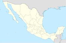
Piedras Negras International Airport
Appearance
Piedras Negras International Airport Aeropuerto Internacional de Piedras Negras | |||||||||||
|---|---|---|---|---|---|---|---|---|---|---|---|
 | |||||||||||
| Summary | |||||||||||
| Airport type | Public | ||||||||||
| Operator | Administradora Coahuilense de Infraestructura y Transporte Aéreo | ||||||||||
| Location | Piedras Negras, Coahuila, Mexico | ||||||||||
| Elevation AMSL | 901 ft / 275 m | ||||||||||
| Coordinates | 28°37′39″N 100°32′07″W / 28.62750°N 100.53528°W | ||||||||||
| Map | |||||||||||
 | |||||||||||
| Runways | |||||||||||
| |||||||||||
| Statistics (2015) | |||||||||||
| |||||||||||
Source: Dirección General de Aeronáutica Civil | |||||||||||
Piedras Negras International Airport (IATA: PDS, ICAO: MMPG) is an international airport located at Piedras Negras, Coahuila, Mexico, near the U.S.-Mexico border. It handles national air traffic for the bi-national metropolitan zone Piedras Negras – Nava / Eagle Pass,TX
It handled 15,034 passengers in 2014, and 17,810 passengers in 2015.
Airlines and destinations

| Airlines | Destinations |
|---|---|
| Aeromar | Mexico City |

