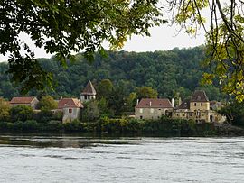
Pontours
Tools
Actions
General
Print/export
Print/export
In other projects
From Wikipedia, the free encyclopedia
This is an old revision of this page, as edited by InternetArchiveBot (talk | contribs) at 02:25, 14 January 2018 (Rescuing 1 sources and tagging 1 as dead. #IABot (v1.6.2) (Balon Greyjoy)). The present address (URL) is a permanent link to this revision, which may differ significantly from the current revision.
Revision as of 02:25, 14 January 2018 by InternetArchiveBot (talk | contribs) (Rescuing 1 sources and tagging 1 as dead. #IABot (v1.6.2) (Balon Greyjoy))
Commune in Nouvelle-Aquitaine, France
Pontours | |
|---|---|
 | |
| Coordinates: 44°50′13″N 0°45′46″E / 44.8369°N 0.7628°E / 44.8369; 0.7628 | |
| Country | France |
| Region | Nouvelle-Aquitaine |
| Department | Dordogne |
| Arrondissement | Bergerac |
| Canton | Lalinde |
| Government | |
| • Mayor (2008–2014) | Marie-Thérèse Armand |
| Area 1 | 6.69 km2 (2.58 sq mi) |
| Population (2008) | 201 |
| • Density | 30/km2 (78/sq mi) |
| Time zone | UTC+01:00 (CET) |
| • Summer (DST) | UTC+02:00 (CEST) |
| INSEE/Postal code | 24334 /24150 |
| Elevation | 36–175 m (118–574 ft) (avg. 44 m or 144 ft) |
| 1 French Land Register data, which excludes lakes, ponds, glaciers > 1 km2 (0.386 sq mi or 247 acres) and river estuaries. | |
Pontours is a commune in the Dordogne department in Nouvelle-Aquitaine in southwestern France.
Population
| Year | Pop. | ±% |
|---|---|---|
| 1962 | 160 | — |
| 1968 | 163 | +1.9% |
| 1975 | 153 | −6.1% |
| 1982 | 164 | +7.2% |
| 1990 | 187 | +14.0% |
| 1999 | 168 | −10.2% |
| 2008 | 201 | +19.6% |
See also
References
External links
Wikimedia Commons has media related to Pontours.
This Dordogne geographical article is a stub. You can help Wikipedia by expanding it. |
Retrieved from "https://en.wikipedia.org/w/index.php?title=Pontours&oldid=820296417"
Hidden categories:
- Articles with short description
- Short description is different from Wikidata
- Coordinates on Wikidata
- Pages using infobox settlement with image map1 but not image map
- Commons category link from Wikidata
- All articles with dead external links
- Articles with dead external links from January 2018
- Articles with permanently dead external links
- All stub articles
- Pages using the Kartographer extension


