Pottstown Municipal Airport
Pottstown Municipal Airport | |||||||||||
|---|---|---|---|---|---|---|---|---|---|---|---|
| Summary | |||||||||||
| Airport type | Public | ||||||||||
| Owner/Operator | Borough of Pottstown | ||||||||||
| Serves | Pottstown, Pennsylvania | ||||||||||
| Elevation AMSL | 256 ft / 78 m | ||||||||||
| Coordinates | 40°15′37″N 075°40′15″W / 40.26028°N 75.67083°W | ||||||||||
| Website | www.pottstown.org/... | ||||||||||
| Map | |||||||||||
 | |||||||||||
| Runways | |||||||||||
| |||||||||||
| Statistics (2008) | |||||||||||
| |||||||||||
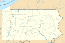
Pottstown Municipal Airport (FAA LID: N47) is a public use airport located in Montgomery County, Pennsylvania, United States. It is owned by the Borough of Pottstown and located two nautical miles (3.7 km) northwest of Pottstown's central business district.[1]
Fly Elite offers regular fixed-base operator (FBO) services, as well as aircraft rentals and flight training. Since 2004, the airport hosts an Annual Airport Community Day to raise awareness of general aviation in its local communities.
Witmer's Aircraft Service offered a full suite of aircraft maintenance and repair services. Founded in 1992, Witmer's Aircraft Service was based at N47 for more than 10 years. Witmer's service is now operated by Fly ELite.
History
In 1946 John Basco and Charles Novack purchased the land now occupied by the airport. Construction of the buildings began a year later, in 1947, and an Open House was held on September 26, 1948. The airport was originally referred to as Stowe Airport or Basco's Airport. A 2,700-foot (820 m)-long runway was built in 1961, and a parallel taxiway was built in 1965. During the 1980s a business park was added.[2]
As part of the federal Airport Improvement Program, the airport began multiple projects over the last few years. In 2003 a new hangar was completed. The fuel farm tanks were refinished in December 2005. The apron and taxiway was repaved in the spring of 2007.[2]
Facilities and aircraft
Pottstown Municipal Airport covers an area of 63 acres (25 ha) at an elevation of 256 feet (78 m) above mean sea level. It has one asphalt paved runway designated 8/26 which measures 2,704 by 75 feet (824 x 23 m).[1]
For the 12-month period ending September 9, 2008, the airport had 24,687 aircraft operations, an average of 67 per day: 96% general aviation, 4% air taxi and <1% military. At that time there were 62 aircraft based at this airport: 97% single-engine and 3% multi-engine.[1]
References
- ^ a b c d FAA Airport Form 5010 for N47 PDF, effective 2009-07-02.
- ^ a b "In The Spotlight: Pottstown Municipal Airport". Borough of Pottstown website. Archived from the original on 2007-09-27. Retrieved 2007-07-23.
{{cite web}}: Unknown parameter|deadurl=ignored (|url-status=suggested) (help)
External links
- Pottstown Municipal Airport page at Borough of Pottstown website
- Fly Elite, the fixed-base operator (FBO)
- FAA Terminal Procedures for N47, effective October 31, 2024
- Resources for this airport:
- FAA airport information for N47
- AirNav airport information for N47
- FlightAware airport information and live flight tracker
- SkyVector aeronautical chart for N47

