
Queets, Washington
This article needs additional citations for verification. (November 2007) |
Queets is an unincorporated community on the border of Jefferson County and Grays Harbor County in Washington, United States.[1] It is near the coast of the Pacific Ocean along the Queets River at the northern edge of the Quinault Indian Reservation. The primary residents of the community are Native Americans of the Quinault Indian Nation. Queets now consists of several homes, a store, gas station, fisheries, daycare, Head Start, and a remote office for the Tribe. The only road access, U.S. Highway 101, crosses the Queets River in Queets, approximately 5 miles (8.0 km) south of Kalaloch Beach. The nearest airport is in Forks, 38 miles (61 km) to the north.
Other local attractions include the Pacific Beach hiking trails, Olympic National Park, and Olympic National Forest.
Queets was a census-designated place in the 2010 United States Census; at the time its population was 174. Its land area is 3.61 square kilometers (1.39 sq mi) and water area is 0.13 square kilometers (0.050 sq mi).[2] More than 95% of the population identified their race as American Indian.[3]
History
The post office at Queets was established July 13, 1880, and finally discontinued July 31, 1934, with mail to Clearwater, approximately 12 miles away.[4]
References
- ^ "Queets Census Designated Place". Geographic Names Information System. United States Geological Survey, United States Department of the Interior.
- ^ "G001: Geographic Identifiers: Queets CDP, Washington". 2010 Census Summary File 1. United States Census Bureau. 2010.
- ^ "DP1: Profile of General Population and Housing Characteristics: Queets CDP, Washington". 2010 Demographic Profile Data. United States Census Bureau. 2010.
- ^ Boardman, Tim, and Richard W. Helbock (1986) Washington Post Offices, p. 55, Lake Oswego, Oregon: La Posta Publications
Municipalities and communities of Jefferson County, Washington, United States | ||
|---|---|---|
| City | 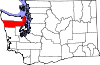 | |
| CDPs | ||
| Other communities | ||
| Indian reservation | ||
| Ghost towns |
| |
| Footnotes | ‡This populated place also has portions in an adjacent county or counties | |
Municipalities and communities of Grays Harbor County, Washington, United States | ||
|---|---|---|
| Cities |  | |
| CDPs | ||
| Other communities | ||
| Indian reservations | ||
| Footnotes | ‡This populated place also has portions in an adjacent county or counties | |
47°32′22″N 124°19′51″W / 47.53944°N 124.33083°W
This Jefferson County, Washington state location article is a stub. You can help Wikipedia by expanding it. |