Rehov
Rehov
| |
|---|---|
 | |
| Coordinates: 32°27′03″N 35°29′23″E / 32.45083°N 35.48972°E | |
| Country | Israel |
| District | Northern |
| Council | Valley of Springs |
| Affiliation | Hapoel HaMizrachi |
| Founded | 1951 |
| Founded by | Kurdish and Moroccan immigrants |
| Population (2022)[1] | 400 |
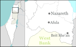
Rehov (Template:Lang-he-n) is a moshav in northern Israel. Located four kilometres south of Beit She'an, it falls under the jurisdiction of Valley of Springs Regional Council. In 2022 it had a population of 400.[1]
History
The moshav was established in 1951 by immigrants from Kurdistan and Morocco. The name was taken from the ancient city of Tel Rehov, which was located in the area.
It is located on the land of the depopulated Palestinian village of Farwana.[2]
References
- ^ a b "Regional Statistics". Israel Central Bureau of Statistics. Retrieved 21 March 2024.
- ^ Khalidi, Walid (1992). All That Remains:The Palestinian Villages Occupied and Depopulated by Israel in 1948. Washington D.C.: Institute for Palestine Studies. p. 47. ISBN 0-88728-224-5.

