
Saks, Alabama
Saks, Alabama | |
|---|---|
 Location in Calhoun County and the state of Alabama | |
| Country | United States |
| State | Alabama |
| County | Calhoun |
| Area | |
| • Total | 12.2 sq mi (31.6 km2) |
| • Land | 12.2 sq mi (31.5 km2) |
| • Water | 0 sq mi (0.1 km2) |
| Elevation | 820 ft (250 m) |
| Population (2010) | |
| • Total | 10,744 |
| • Density | 880/sq mi (340/km2) |
| Time zone | UTC-6 (Central (CST)) |
| • Summer (DST) | UTC-5 (CDT) |
| FIPS code | 01-67608 |
| GNIS feature ID | 0126228 |
Saks is an unincorporated census-designated place in Calhoun County, Alabama, United States. At the 2000 census the population was 10,744.Template:GR It is included in the Anniston-Oxford Metropolitan Statistical Area.
Geography
Saks is located at 33°42'29.527" North, 85°50'39.574" West (33.708202, -85.844326)Template:GR.
According to the U.S. Census Bureau, the community has a total area of 12.2 square miles (32 km2), of which 12.2 square miles (32 km2) of it is land and 0.33% is water.
Demographics
| Census | Pop. | Note | %± |
|---|---|---|---|
| 1980 | 11,118 | — | |
| 1990 | 11,138 | 0.2% | |
| 2000 | 10,698 | −4.0% | |
| 2010 | 10,744 | 0.4% | |
| source:[1] | |||
As of the censusTemplate:GR of 2000, there were 10,698 people, 4,286 households, and 3,141 families residing in the community. The population density was 886.7 people per square mile (342.2/km²). There were 4,680 housing units at an average density of 387.9 per square mile (149.7/km²). The racial makeup of the community was 84.47% White, 12.85% Black or African American, 0.39% Native American, 0.70% Asian, 0.07% Pacific Islander, 0.52% from other races, and 0.98% from two or more races. 1.65% of the population were Hispanic or Latino of any race.
There were 4,286 households out of which 31.2% had children under the age of 18 living with them, 58.2% were married couples living together, 11.4% had a female householder with no husband present, and 26.7% were non-families. 23.1% of all households were made up of individuals and 9.4% had someone living alone who was 65 years of age or older. The average household size was 2.50 and the average family size was 2.93.
In the community the population was spread out with 23.8% under the age of 18, 8.9% from 18 to 24, 27.9% from 25 to 44, 25.9% from 45 to 64, and 13.6% who were 65 years of age or older. The median age was 38 years. For every 100 females there were 91.9 males. For every 100 females age 18 and over, there were 89.8 males.
The median income for a household in the community was $37,321, and the median income for a family was $42,183. Males had a median income of $30,322 versus $21,285 for females. The per capita income for the CDP was $18,792. About 8.5% of families and 11.1% of the population were below the poverty line, including 16.2% of those under age 18 and 6.3% of those age 65 or over.
Education
There is an elementary school, a middle school, and a high school located within the community. These schools are administered by the Calhoun County School System. Saks High School's athletic teams (known as the Wildcats) currently competes in Class 4A of the Alabama High School Athletic Association but will begin competing in Class 3A with the 2010 realignment.
References
- ^ "CENSUS OF POPULATION AND HOUSING (1790-2000)". U.S. Census Bureau. Retrieved 2010-08-07.
33°42′30″N 85°50′40″W / 33.708202°N 85.844326°W
Municipalities and communities of Calhoun County, Alabama, United States | ||
|---|---|---|
| Cities | 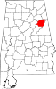 | |
| Towns | ||
| CDPs | ||
| Unincorporated communities | ||
| Ghost town | ||
| Footnotes | ‡This populated place also has portions in an adjacent county or counties | |