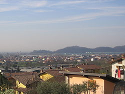
San Paolo d'Argon
San Paolo d'Argon | |
|---|---|
| Comune di San Paolo d'Argon | |
 | |
| Country | Italy |
| Region | Lombardy |
| Province | Bergamo (BG) |
| Government | |
| • Mayor | Elena Pezzoli |
| Area | |
• Total | 5.07 km2 (1.96 sq mi) |
| Elevation | 255 m (837 ft) |
| Population (2007)[2] | |
• Total | 5,309 |
| • Density | 1,000/km2 (2,700/sq mi) |
| Demonym | Sampaolesi |
| Time zone | UTC+1 (CET) |
| • Summer (DST) | UTC+2 (CEST) |
| Postal code | 24060 |
| Dialing code | 035 |
| Website | Official website |
San Paolo d'Argon is a comune (municipality) in the Province of Bergamo in the Italian region of Lombardy, located about 60 kilometres (37 mi) northeast of Milan and about 11 kilometres (7 mi) east of Bergamo.
In the Middle Ages it was home to a large Cluniac monastery, founded in 1079. It was restored in the 16th century, as shown by the cloisters (1500 and 1532). In the former refectory are frescoes (1624) by Giovanni Battista Lorenzetti. The annexed church was rebuilt from 1684. The nave's vault is decorated with frescoes by Giulio Quaglio (1712–13), while other artworks include canvasses by Giuseppe Maria Crespi, Sebastiano Ricci and Antonio Balestra.
Until the early 20th century, the town was known as Buzzone, while the name "San Paolo d'Argon" designed the monastic complex.
References
- ^ "Superficie di Comuni Province e Regioni italiane al 9 ottobre 2011". Italian National Institute of Statistics. Retrieved 16 March 2019.
- ^ All demographics and other statistics: Italian statistical institute Istat.
External links

