Saskatchewan River Forks
| Saskatchewan River Forks Recreation Site | |
|---|---|
| Location | RM of Prince Albert No. 461, Saskatchewan |
| Nearest city | Prince Albert |
| Coordinates | 53°13′49″N 105°05′03″W / 53.2304°N 105.0843°W |
| Elevation | 378 m (1,240 ft) |
| Governing body | Province of Saskatchewan |
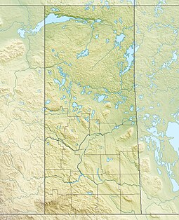
Saskatchewan River Forks is a provincial recreation site[1] in the Canadian province of Saskatchewan at the confluence of the North Saskatchewan and South Saskatchewan Rivers.[2] The rivers, which have their headwaters in the Rocky Mountains, come together to form the Saskatchewan River.[3][4] A major intersection when waterways were important to transportation on the Canadian Prairies, first with the fur trade and then during the riverboat era, today the Saskatchewan River Forks attract tourists, canoeists, and recreational fishermen.[5]
The recreation site, which is maintained by the province of Saskatchewan, is about 50 kilometres (31 mi) east of Prince Albert and 33 kilometres (21 mi) north of Weldon. Access is 13 kilometres (8.1 mi) off Highway 302. The park is on the west side of the river fork and is heavily wooded with steep banks. There is a tourist picnic site, hiking trails, and historic markers.[6]
Saskatchewan River Forks history
[edit]In 1692, Englishman Henry Kelsey — while working for the Hudson's Bay Company — was the first European to reach the Saskatchewan River Forks. While he didn't set up a trading fort at the Forks, his journey helped open up the prairies for the North American fur trade.[7] Trading posts along rivers were important to European fur traders. In 1751, a New France fur-trading post, Fort La Jonquière, was established on the Saskatchewan River (or one of its branches) possibly at, or near, the Forks by Jacques Legardeur de Saint-Pierre. In 1753, a second French fur-trading post, Fort de la Corne, was established in the area by Louis de la Corne, Chevalier de la Corne.[8][9]
See also
[edit]- List of protected areas of Saskatchewan
- Saskatchewan Valley
- History of Saskatchewan
- Geography of Saskatchewan
References
[edit]- ^ "Saskatchewan River Forks Recreation Site". Canadian Geographical Names Database. Government of Canada. Retrieved 13 January 2024.
- ^ "Saskatchewan River". WorldAtlas. Worldatlas.com. 10 September 2021. Retrieved 15 January 2024.
- ^ Newton, Brandi (18 February 2009). "Saskatchewan River". The Canadian Encyclopedia. Retrieved 14 January 2024.
- ^ "The Forks". www.natureprincealbert.ca. Retrieved 23 May 2020.
- ^ "Saskatchewan River Forks Recreation Site, Saskatchewan Map". Geodata.us. Retrieved 14 January 2024.
- ^ "Saskatchewan River Forks Recreation Site | Tourism Saskatchewan". www.tourismsaskatchewan.com. Retrieved 23 May 2020.
- ^ Coutts, Robert (7 January 2008). "Henry Kelsey". The Canadian Encyclopedia. Retrieved 15 January 2024.
- ^ "The Quebec History Encyclopedia". Quebec History. Claude Bélanger, Marianopolis College. Retrieved 15 January 2024.
- ^ "Fort de la Corne Historic Site". BRMB Maps. Mussio Ventures Ltd. Retrieved 15 January 2024.
External links
[edit]- http://wikimapia.org/937546/ - WikiMapia site showing aerial view of the Saskatchewan River Forks.


