
Sers, Hautes-Pyrénées
Sers | |
|---|---|
 The town hall | |
.svg) Coat of arms | |
Location of Sers  | |
 Sers  Sers | |
| Coordinates: 42°53′17″N 0°02′21″E / 42.8881°N 0.0392°E | |
| Country | France |
| Region | Occitania |
| Department | Hautes-Pyrénées |
| Arrondissement | Argelès-Gazost |
| Canton | La Vallée des Gaves |
| Area 1 | 29.91 km2 (11.55 sq mi) |
| Population (1999) | 102 |
| • Density | 3.4/km2 (8.8/sq mi) |
| Time zone | UTC+01:00 (CET) |
| • Summer (DST) | UTC+02:00 (CEST) |
| INSEE/Postal code | 65424 /65120 |
| Elevation | 928–2,872 m (3,045–9,423 ft) (avg. 1,100 m or 3,600 ft) |
| 1 French Land Register data, which excludes lakes, ponds, glaciers > 1 km2 (0.386 sq mi or 247 acres) and river estuaries. | |
Sers is a commune in the Hautes-Pyrénées department in south-western France.
See also
Gallery
-
 église Saint-Vincent
 -

-
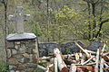
 Fontaine 1616
 -
 Croix
Croix -
 Croix Saint-Justin
 -
 Monument aux morts
 -
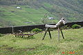 L'animal laboureur
 -
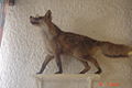 Le renard de Rozette


References
Wikimedia Commons has media related to Sers (Hautes-Pyrénées).
This Hautes-Pyrénées geographical article is a stub. You can help Wikipedia by expanding it. |