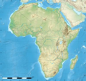
Sidi Slimane, Morocco
Sidi Slimane
ⵙⵉⴷⵉ ⵙⵍⵉⵎⴻⵏ | |
|---|---|
city | |
| Coordinates: 34°13′N 5°42′W / 34.217°N 5.700°W | |
| Country | |
| Region | Rabat-Salé-Kénitra |
| Province | Sidi Slimane |
| Elevation | 135 ft (41 m) |
| Population (2014)[1] | |
| • Total | 92,989 |
| Time zone | UTC+0 (WET) |
| • Summer (DST) | UTC+1 (WEST) |
Sidi Slimane is a small city in the northwestern centre of Morocco in the Rabat-Salé-Kénitra economic region. It is the administrative headquarters for Sidi Slimane Province and is located between the major cities of Kenitra and Meknes.
The city recorded a population of 92,989 in the 2014 Moroccan census,[1] up from 78,060 inhabitants in 2004.
The economy is mainly focused on agriculture. Its population is mostly of rural migrants. The society is still plagued with major problems such as illiteracy, unemployment and slums.[2] Sidi Slimane is mostly renowned for its quality citrus products. It has three high schools, a public library, a downtown called "filaj" (village in French) and a local stadium.
Sidi Slimane is home to a Moroccan Air Force base, Sidi Slimane Air Base.
It lies on the main railway line from Tanger to Oujda.
Notes
- ^ a b "POPULATION LÉGALE DES RÉGIONS, PROVINCES, PRÉFECTURES, MUNICIPALITÉS, ARRONDISSEMENTS ET COMMUNES DU ROYAUME D'APRÈS LES RÉSULTATS DU RGPH 2014" (in Arabic and French). High Commission for Planning, Morocco. 8 April 2015. Retrieved 29 September 2017.
- ^ "Sidi Slimane: Nouvelle approche contre l'habitat insalubre (Sidi Slimane: New Approach against slums)" (in French). Sidi Slimane City. 8 November 2010. Archived from the original on 28 May 2014. citing Boumehdi, Ahmed (7 November 2010). "Sidi Slimane: Nouvelle approche contre l'habitat insalubre". Le Matin du Sahara et du Maghreb.
References
- Thomas, Tay and Thomas, Lowell Jr. (1956) Our Flight to Adventure Doubleday, OCLC 1328511
External links
34°16′N 5°55′W / 34.26°N 5.92°W


