Subdivisions of Brazil
Appearance

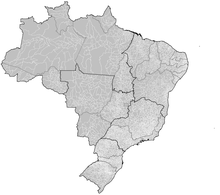
Brazil is divided into several types and levels of administrative subdivisions.
Regions
Since 1942, the Brazilian Institute of Geography and Statistics has divided Brazil into five administrative regions.[1] On 23 November 1970, the regions of Brazil were adjusted slightly to the definition that is still in use today.[2]
- North Region (Região Norte)
- Northeast Region (Região Nordeste)
- Central-West Region (Região Centro-Oeste)
- Southeast Region (Região Sudeste)
- South Region (Região Sul)
States
Brazil is divided into 27 federative units: the Federal District, Distrito Federal (DF), and 26 states:
|
|
Municipalities
There are over 5500 municipalities in Brazil. The Federal District is divided into 31 administrative regions.
Statistical Areas
For statistical purposes, Brazilian municipalities are grouped together into mesoregions and microregions.
See also
References
- ^ "Divisão Regional". ibge.gov.br (in Portuguese). Instituto Brasileiro de Geografia e Estatística. Retrieved 15 November 2015.
- ^ Contel, Fabio Betioli. "As divisões regionais do IBGE no século XX (1942, 1970 e 1990)". terrabrasilis.revues.org (in Portuguese). Terra Brasilis: Revista da Rede Brasileira de História da Geografia e Geografia Histórica. doi:10.4000/terrabrasilis.990. Retrieved 15 November 2015.

