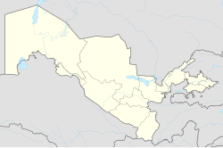
Termez Airport
Appearance
Termez Airport Termiz Aeroporti | |||||||||||
|---|---|---|---|---|---|---|---|---|---|---|---|
| Summary | |||||||||||
| Airport type | Public | ||||||||||
| Owner | Government of Uzbekistan | ||||||||||
| Operator | Uzbekistan Airways | ||||||||||
| Serves | Termez | ||||||||||
| Location | Termez, Uzbekistan | ||||||||||
| Elevation AMSL | 1,027 ft / 313 m | ||||||||||
| Coordinates | 37°17′12″N 067°18′36″E / 37.28667°N 67.31000°E | ||||||||||
 | |||||||||||
| Runways | |||||||||||
| |||||||||||
Termez Airport (IATA: TMJ, ICAO: UTST) is an airport serving Termez, a city in southern Uzbekistan. It is used as a base for German Air Force C-160 "Transalls" which are part of the German ISAF-contingent.
Airlines and destinations
| Airlines | Destinations |
|---|---|
| Uzbekistan Airways | Moscow-Domodedovo, St Petersburg, Tashkent |
| VIM Airlines | Moscow-Domodedovo |
See also
References
- ^ Template:WAD
- ^ Airport information for TMJ at Great Circle Mapper. Source: DAFIF (effective October 2006).

