
Thompson Township, Michigan
Thompson Township, Michigan | |
|---|---|
 Thompson Township, Michigan Location within the state of Michigan | |
| Coordinates: 45°58′30″N 86°21′49″W / 45.97500°N 86.36361°W | |
| Country | United States |
| State | Michigan |
| County | Schoolcraft |
| Area | |
| • Total | 118.4 sq mi (306.6 km2) |
| • Land | 112.9 sq mi (292.5 km2) |
| • Water | 5.4 sq mi (14.1 km2) |
| Elevation | 682 ft (208 m) |
| Population (2000) | |
| • Total | 671 |
| • Density | 5.9/sq mi (2.3/km2) |
| Time zone | UTC-5 (Eastern (EST)) |
| • Summer (DST) | UTC-4 (EDT) |
| ZIP code | 49854 |
| Area code | 906 |
| FIPS code | 26-79580[1] |
| GNIS feature ID | 1627161[2] |
Thompson Township is a civil township of Schoolcraft County in the U.S. state of Michigan. As of the 2000 census, the township had a total population of 671.
History
After the timber boom of the late 19th century, Thompson Township's chief assets included second-growth trees such as balsam and aspen. The schooner Rouse Simmons, loaded with balsam Christmas trees, left Thompson Harbor for Chicago in November, 1912. The schooner sank with all hands off Two Rivers, Wisconsin, becoming one of the most famous shipwrecks in Lake Michigan history.
Geography
According to the United States Census Bureau, the township has a total area of 118.4 square miles (307 km2), of which 112.9 square miles (292 km2) is land and 5.4 square miles (14 km2) water. The total area is 4.59% water.
Demographics
As of the census[1] of 2000, there were 671 people, 278 households, and 219 families living in the township. The population density was 5.9 per square mile (2.3/km²). There were 608 housing units at an average density of 5.4 per square mile (2.1/km²). The racial makeup of the township was 87.93% White, 0.30% African-American, 9.54% Native American, 0.15% Asian, 0.30% from other races, and 1.79% from two or more races. Hispanic or Latino of any race were 0.30% of the population.
There were 278 households out of which 26.3% had children under the age of 18 living with them, 71.9% were married couples living together, 3.6% had a female householder with no husband present, and 21.2% were non-families. 16.9% of all households were made up of individuals and 8.3% had someone living alone who was 65 years of age or older. The average household size was 2.41 and the average family size was 2.68.
In the township the population was spread out with 19.8% under the age of 18, 5.7% from 18 to 24, 23.0% from 25 to 44, 34.1% from 45 to 64, and 17.4% who were 65 years of age or older. The median age was 46 years. For every 100 females, there were 100.3 males. For every 100 females age 18 and over, there were 103.0 males.
The median income for a household in the township was $38,750, and the median income for a family was $41,731. Males had a median income of $41,250 versus $26,500 for females. The per capita income for the township was $24,045. About 7.5% of families and 8.8% of the population were below the poverty line, including 7.3% of those under the age of 18 and 3.8% of those 65 and older.
Transportation
Indian Trails provides daily intercity bus service via Thompson between St. Ignace and Ironwood, Michigan.[3]
References
- ^ a b "American FactFinder". United States Census Bureau. Retrieved 2008-01-31.
- ^ U.S. Geological Survey Geographic Names Information System: Thompson Township, Michigan
- ^ "ST. IGNACE-SAULT STE. MARIE-IRONWOOD" (PDF). Indian Trails. January 15, 2013. Archived from the original (PDF) on July 4, 2014. Retrieved 2013-02-28.
{{cite web}}: Unknown parameter|deadurl=ignored (|url-status=suggested) (help)
Municipalities and communities of Schoolcraft County, Michigan, United States | ||
|---|---|---|
| City | 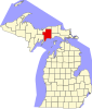 | |
| Civil townships | ||
| Unincorporated communities | ||
| Indian reservation | ||
| Footnotes | ‡This populated place also has portions in an adjacent county or counties | |