Jump to content

Tskhenistsqali

Coordinates: 42°07′31″N 42°17′56″E / 42.1252°N 42.2989°E / 42.1252; 42.2989
From Wikipedia, the free encyclopedia

This is an old revision of this page, as edited by Addbot (talk | contribs) at 12:15, 27 February 2013 (Bot: Migrating 6 interwiki links, now provided by Wikidata on d:q2040044 (Report Errors)). The present address (URL) is a permanent link to this revision, which may differ significantly from the current revision.

Tskhenistsqali
Map
Physical characteristics
MouthRioni River 42°07′31″N 42°17′56″E / 42.1252°N 42.2989°E / 42.1252; 42.2989
Length184 km (114 mi)

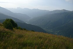
Tskhenistsqali (Georgian: ცხენისწყალი) is a river in northern Georgia. Its source is in the main range of the Caucasus Mountains, in the easternmost part of the Lentekhi District, lower Svaneti. A tributary of the river Rioni, its length is 184 km.[1] It flows through the small towns Lentekhi and Tsageri and joins the Rioni near the town Samtredia.

References

  1. ^ Ministry of Economic Development of Georgia. Department of Statistics (Tbilisi, 2008), Statistical Yearbook of Georgia: 2007, p. 12.