
Tușnad
Tușnad
Tusnád | |
|---|---|
Commune | |
 | |
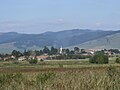
 Location of Tușnad | |
| Coordinates: 46°12′0″N 25°54′0″E / 46.20000°N 25.90000°E | |
| Country | |
| County | Harghita County |
| Status | Commune |
| Government | |
| • Mayor | Endre Rafain[1] (Democratic Union of Hungarians in Romania) |
| Area | |
| • Total | 76.64 km2 (29.59 sq mi) |
| Population (2011[2]) | |
| • Total | 2,117 |
| Time zone | UTC+2 (EET) |
| • Summer (DST) | UTC+3 (EEST) |
Tușnad (Hungarian: Tusnád, Hungarian pronunciation: [ˈtuʃnaːd]) is a commune in Harghita County, Romania. It lies in the Székely Land, an ethno-cultural region in eastern Transylvania, and is composed of three villages:
| In Romanian | In Hungarian |
|---|---|
| Tușnad | Tusnád |
| Tușnadu Nou | Újtusnád |
| Vrabia | Csíkverebes |
Demographics
The commune has an absolute Székely Hungarian majority. According to the 2011 census it has a population of 2,117 which 92.73% or 1,963 are Hungarian.
Name
The village of Tusnád is often referred to as Tușnad-Sat or Tusnád-Falu to avoid confusion with the touristic centre of Băile Tușnad to the south. Romanian State Railways also makes this distinction.
References
- ^ Template:Ro icon Alegeri locale 2012 - Rezultate alegeri Primăria Tuşnad; retrieved on March 24 2013
- ^ Template:Ro harghita.insse.ro - Recensământul Populaţiei şi al locuinţelor 2011, judeţul Harghita (date provizorii)[permanent dead link]; retrieved on March 24 2013
-
 Tuşnad
 -
 Tuşnadu Nou
 -
 Vrabia


This Harghita County location article is a stub. You can help Wikipedia by expanding it. |