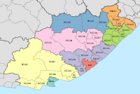
Umzimvubu Local Municipality
Umzimvubu | |
|---|---|
 Location in the Eastern Cape | |
| Coordinates: 32°10′S 28°35′E / 32.167°S 28.583°E | |
| Country | South Africa |
| Province | Eastern Cape |
| District | Alfred Nzo |
| Seat | Mount Frere |
| Wards | 27 |
| Government | |
| • Type | Municipal council |
| • Mayor | Sobane Mnukwa (ANC) |
| • Speaker | Nofikile Florida Ngonyolo (ANC) |
| • Chief Whip | Ndanele Mzinwa (ANC) |
| Area | |
• Total | 2,577 km2 (995 sq mi) |
| Population (2011)[2] | |
• Total | 191,620 |
| • Density | 74/km2 (190/sq mi) |
| Racial makeup (2011) | |
| • Black African | 99.4% |
| • Coloured | 0.3% |
| • Indian/Asian | 0.1% |
| • White | 0.1% |
| First languages (2011) | |
| • Xhosa | 93.1% |
| • English | 2.6% |
| • Other | 4.3% |
| Time zone | UTC+2 (SAST) |
| Municipal code | EC442 |
Umzimvubu Municipality (Xhosa: uMasipala wase Umzimvubu) is a local municipality within the Alfred Nzo District Municipality, in the Eastern Cape province of South Africa. Umzimvubu, the name of the Mzimvubu River, is an isiXhosa word meaning "home of the hippopotamus". The municipal area comprises an area of 2506 square kilometres. The municipality has undergone a number of amendments in terms of municipal and ward demarcation which has a profound impact on planning in the area.
Main places
[edit]The 2001 census divided the municipality into the following main places:[3]
| Place | Code | Area (km2) | Population | Most spoken language |
|---|---|---|---|---|
| Amahlubi | 23801 | 92.17 | 2,814 | Xhosa |
| Bakoena | 23802 | 528.40 | 31,417 | Sotho |
| Bhele | 23803 | 2.66 | 540 | Xhosa |
| Fikeni | 23804 | 142.30 | 15,767 | Xhosa |
| Hlubi | 23805 | 52.81 | 4,233 | Xhosa |
| Ludidi | 23806 | 281.33 | 13,846 | Xhosa |
| Lupindo | 23807 | 187.89 | 12,034 | Xhosa |
| Lwandlolubomvu | 23808 | 3.76 | 787 | Xhosa |
| Makaula | 23809 | 1,488.73 | 100,632 | Xhosa |
| Malubelube | 23810 | 68.68 | 21,730 | Xhosa |
| Mandileni | 296083 296101 296102 296149 |
11.70 | 2,267 | Xhosa |
| Manguzela | 23812 | 117.54 | 12,044 | Xhosa |
| Matandela | 23813 | 98.75 | 4,985 | Xhosa |
| Maxesibeni | 23814 | 97.92 | 5,512 | Xhosa |
| Mosesh | 23815 | 474.54 | 35,501 | Sotho |
| Mount Ayliff | 23816 | 19.52 | 4,881 | Xhosa |
| Mount Frere | 23817 | 14.74 | 7,655 | Xhosa |
| Mpoza | 23818 | 210.04 | 11,604 | Xhosa |
| Mzongwana | 23819 | 244.84 | 13,100 | Xhosa |
| Sibi | 23820 | 326.42 | 30,275 | Xhosa |
| Umzimvubu Part 1 | 23821 | 55.55 | 2,268 | Xhosa |
| Umzimvubu Part 2 | 23825 | 162.00 | 721 | Xhosa |
| Xesibe | 23822 | 385.59 | 41,825 | Xhosa |
Politics
[edit]The municipal council consists of fifty-five members elected by mixed-member proportional representation. Twenty-eight councillors are elected by first-past-the-post voting in twenty-eight wards, while the remaining twenty-seven are chosen from party lists so that the total number of party representatives is proportional to the number of votes received. In the election of 1 November 2021 the African National Congress (ANC) won a majority of forty-two seats on the council. The following table shows the results of the election.[4]
| Party | Ward | List | Total seats | |||||
|---|---|---|---|---|---|---|---|---|
| Votes | % | Seats | Votes | % | Seats | |||
| African National Congress | 38,169 | 77.60 | 28 | 37,352 | 76.09 | 14 | 42 | |
| Economic Freedom Fighters | 4,884 | 9.93 | 0 | 4,955 | 10.09 | 6 | 6 | |
| Democratic Alliance | 2,042 | 4.15 | 0 | 2,018 | 4.11 | 2 | 2 | |
| African Transformation Movement | 1,352 | 2.75 | 0 | 1,370 | 2.79 | 2 | 2 | |
| United Democratic Movement | 1,264 | 2.57 | 0 | 1,310 | 2.67 | 2 | 2 | |
| African Independent Congress | 585 | 1.19 | 0 | 1,448 | 2.95 | 1 | 1 | |
| Socialist Revolutionary Workers Party | 330 | 0.67 | 0 | 208 | 0.42 | 0 | 0 | |
| Independent candidates | 379 | 0.77 | 0 | 0 | ||||
| Socialist Party of South Africa | 99 | 0.20 | 0 | 241 | 0.49 | 0 | 0 | |
| Independent South African National Civic Organisation | 86 | 0.17 | 0 | 188 | 0.38 | 0 | 0 | |
| Total | 49,190 | 100.00 | 28 | 49,090 | 100.00 | 27 | 55 | |
| Valid votes | 49,190 | 97.93 | 49,090 | 97.79 | ||||
| Invalid/blank votes | 1,042 | 2.07 | 1,111 | 2.21 | ||||
| Total votes | 50,232 | 100.00 | 50,201 | 100.00 | ||||
| Registered voters/turnout | 106,760 | 47.05 | 106,760 | 47.02 | ||||
References
[edit]- ^ "Contact list: Executive Mayors". Government Communication & Information System. Archived from the original on 14 July 2010. Retrieved 22 February 2012.
- ^ a b c "Statistics by place". Statistics South Africa. Retrieved 27 September 2015.
- ^ Lookup Tables - Statistics South Africa[dead link]
- ^ "Election Result Table for LGE2021 — Umzimvubu". wikitable.frith.dev. Retrieved 12 February 2022.


